
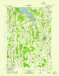
1943 Map of Wolcott
USGS Topo · Published 1943About this map
Wolcott sits at the heart of this Wayne County landscape, where the confluence of Wolcott Creek and numerous rural roads defines the local commerce of the early 1940s. The region is marked by a dense network of small hamlets and family-named intersections such as Lockwood Corners, Stewart Corners, and Maunders Corners, illustrating the decentralized nature of agricultural life during this era.
Find a feature on this map
62 named features on this map. Tap any name to fly to it.
Don’t see what you’re looking for? This feature index may not catch every label — zoom into the map to look around manually.
Map Details
Editions of this 1943 Wolcott Map
This is the sole edition of this map. No revisions or reprints were ever made.
Other maps of this area

1900 · Oswego
USGS Topo · 1:62,500

1902 · Sodus Bay
USGS Topo · 1:62,500

1902 · Clyde
USGS Topo · 1:62,500

1902 · Weedsport
USGS Topo · 1:62,500

1943 · Lyons
USGS Topo · 1:31,680

1943 · Montezuma
USGS Topo · 1:31,680

1943 · Sodus Point
USGS Topo · 1:31,680

1943 · Savannah
USGS Topo · 1:31,680

1943 · Fair Haven
USGS Topo · 1:31,680
1943 · Rose
USGS Topo · 1:31,680