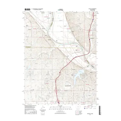
2015 Map of Wolcott
USGS Topo · Published 2015About this map
Wyandotte County Lake dominates the southern landscape of this Missouri River borderland, where the water bends around Diamond Island and Stigers Island. The river's winding course creates distinct geographic features like Pope Bend and Pomeroy Bend, which historically influenced the placement of settlements and transport routes. This survey highlights the complex boundary where Kansas City meets smaller historical communities such as Pomeroy, Wolcott, and Piper. Cultural markers are abundant, ranging from the aviation history at Noah's Ark Airport to numerous local burial grounds including Dunagan Cem and Ellis Cem. The transition from the rural bluffs of Waldron and Parkville to the expanding suburbs of Loma Vista and Vinewood illustrates the evolving land use patterns of the mid-2010s in this bi-state region.
Find a feature on this map
104 named features on this map. Tap any name to fly to it.
Don’t see what you’re looking for? This feature index may not catch every label — zoom into the map to look around manually.
Map Details
Editions of this 2015 Wolcott Map
This is the sole edition of this map. No revisions or reprints were ever made.
Other maps of this area

1890 · Kansas City
USGS Topo · 1:125,000

1894 · Kansas City
USGS Topo · 1:125,000

1910 · Leavenworth
USGS Topo · 1:62,500

1914 · Smithville
USGS Topo · 1:62,500

1934 · Bonner Springs
USGS Topo · 1:48,000

1934 · Shawnee
USGS Topo · 1:24,000

1934 · Edwardsville
USGS Topo · 1:24,000

1934 · Wolcott
USGS Topo · 1:24,000

1940 · Bonner Springs
USGS Topo · 1:62,500
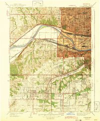
1943 · Shawnee
USGS Topo · 1:31,680