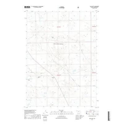
2017 Map of Wolf Butte
USGS Topo · Published 2017About this map
Oglala National Grassland dominates the central portion of this Dawes County landscape, where the high plains of northwest Nebraska transition into a terrain of prominent buttes and draws. The map illustrates a ranching-focused economy defined by scattered water management systems, including McMeekin Reservoir, Snook Reservoir, and Board Gate Dam Reservoir. These small impoundments are essential features in a semi-arid environment carved by seasonal drainages such as Green Tree Cr and Collingwood Cr. Notable landmarks like Wolf Butte and Strawstack Butte rise above the drainage of the North Draw, providing critical orientation points in a region of few roads. The presence of Pete Smith Hill and family-named routes like Snook Rd and McMeekin Rd underscores the long-standing ranching heritage and land ownership patterns that have shaped this corner of the state.
Find a feature on this map
25 named features on this map. Tap any name to fly to it.
Don’t see what you’re looking for? This feature index may not catch every label — zoom into the map to look around manually.
Map Details
Editions of this 2017 Wolf Butte Map
This is the sole edition of this map. No revisions or reprints were ever made.
Other maps of this area

1896 · Oelrichs
USGS Topo · 1:125,000

1900 · Oelrichs
USGS Topo · 1:125,000

1902 · Edgemont
USGS Topo · 1:125,000

1955 · Hot Springs
USGS Topo · 1:250,000

1955 · Alliance
USGS Topo · 1:250,000

1957 · Alliance
USGS Topo · 1:250,000

1958 · Alliance
USGS Topo · 1:250,000

1980 · Horn
USGS Topo · 1:24,000

1980 · Wolf Butte
USGS Topo · 1:24,000

1980 · Lone Tree Ranch
USGS Topo · 1:24,000