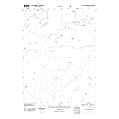
2011 Map of Wolf Creek Summit
USGS Topo · Published 2011About this map
Wolf Creek Summit serves as the high-elevation focal point of this 2011 survey, marking the transition between the headwaters of several major drainage systems. The landscape is defined by the high crest of Duchesne Ridge and the Shale Ridge, which separate the western flow of the South Fork Provo River from the easterly progress of the West Fork Duchesne River. Human activity in this mountainous region is concentrated around water management and recreation, anchored by the Mill Hollow Reservoir and its associated Mill Hollow Dam. Seasonal campsites such as Mill Hollow Campground and Wolf Creek Campground provide access to the high backcountry. Historically significant grazing lands and open basins, including Beef Pasture, Jimmies Basin, and Scotty Basin, reflect the area's utility for high-altitude livestock management throughout the twentieth century.
Find a feature on this map
43 named features on this map. Tap any name to fly to it.
Don’t see what you’re looking for? This feature index may not catch every label — zoom into the map to look around manually.
Map Details
Editions of this 2011 Wolf Creek Summit Map
This is the sole edition of this map. No revisions or reprints were ever made.
Other maps of this area

1885 · Salt Lake
USGS Topo · 1:250,000

1885 · Uinta
USGS Topo · 1:250,000

1900 · Coalville
USGS Topo · 1:125,000

1901 · Hayden Peak
USGS Topo · 1:125,000

1903 · Hayden Peak
USGS Topo · 1:125,000

1903 · Coalville
USGS Topo · 1:125,000

1907 · Strawberry Valley
USGS Topo · 1:125,000

1909 · Strawberry Valley
USGS Topo · 1:125,000

1954 · Salt Lake City
USGS Topo · 1:250,000

1958 · Salt Lake City
USGS Topo · 1:250,000