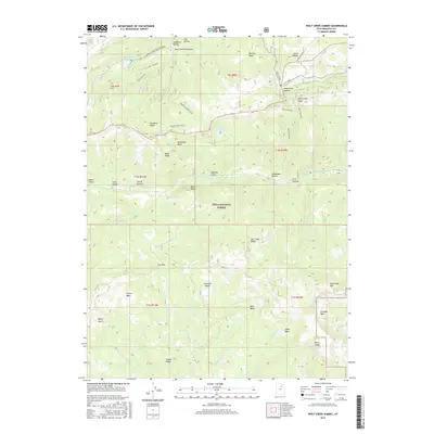
2017 Map of Wolf Creek Summit
USGS Topo · Published 2017About this map
Uinta National Forest lands dominate this high-elevation landscape, where numerous headwater streams descend from prominent ridges. The area is a complex network of basins and hollows, most notably Mill Hollow Reservoir and the high divide at Wolf Creek Summit. Long-established routes like the Granite School Trail and Yellow Lake Trail traverse the steep terrain, connecting points between Duchesne Ridge and Wolf Creek Peak. The hydrography of the region is particularly dense, showing the beginnings of the Strawberry River, the West Fork Duchesne River, and the South Fork Provo River. This map captures the intricate drainage patterns and named landmarks like Scotty Basin and Jones Cabin Creek that define this portion of the Wasatch range.
Find a feature on this map
55 named features on this map. Tap any name to fly to it.
Don’t see what you’re looking for? This feature index may not catch every label — zoom into the map to look around manually.
Map Details
Editions of this 2017 Wolf Creek Summit Map
This is the sole edition of this map. No revisions or reprints were ever made.
Other maps of this area

1885 · Salt Lake
USGS Topo · 1:250,000

1885 · Uinta
USGS Topo · 1:250,000

1900 · Coalville
USGS Topo · 1:125,000

1901 · Hayden Peak
USGS Topo · 1:125,000

1903 · Hayden Peak
USGS Topo · 1:125,000

1903 · Coalville
USGS Topo · 1:125,000

1907 · Strawberry Valley
USGS Topo · 1:125,000

1909 · Strawberry Valley
USGS Topo · 1:125,000

1954 · Salt Lake City
USGS Topo · 1:250,000

1958 · Salt Lake City
USGS Topo · 1:250,000