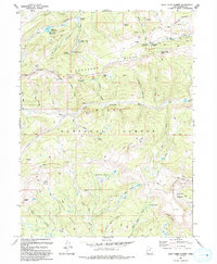
1993 Map of Wolf Creek Summit
USGS Topo · Published 1993About this map
Uinta National Forest lands dominate this high-altitude landscape in the early 1990s, where the headwaters of several major Utah drainages originate. The terrain is defined by prominent divides such as Duchesne Ridge and Coyote Ridge, which separate the flows of the Duchesne River and the South Fork Provo River. At the northern edge, the Mill Hollow Reservoir and the nearby Mill Hollow FS Station mark a node of administrative and recreational activity, including the Mill Hollow Granite Sch Center.
Find a feature on this map
55 named features on this map. Tap any name to fly to it.
Don’t see what you’re looking for? This feature index may not catch every label — zoom into the map to look around manually.
Map Details
Editions of this 1993 Wolf Creek Summit Map
This is the sole edition of this map. No revisions or reprints were ever made.
Other maps of this area

1885 · Salt Lake
USGS Topo · 1:250,000

1885 · Uinta
USGS Topo · 1:250,000

1900 · Coalville
USGS Topo · 1:125,000

1901 · Hayden Peak
USGS Topo · 1:125,000

1903 · Hayden Peak
USGS Topo · 1:125,000

1903 · Coalville
USGS Topo · 1:125,000

1907 · Strawberry Valley
USGS Topo · 1:125,000

1909 · Strawberry Valley
USGS Topo · 1:125,000

1954 · Salt Lake City
USGS Topo · 1:250,000

1958 · Salt Lake City
USGS Topo · 1:250,000