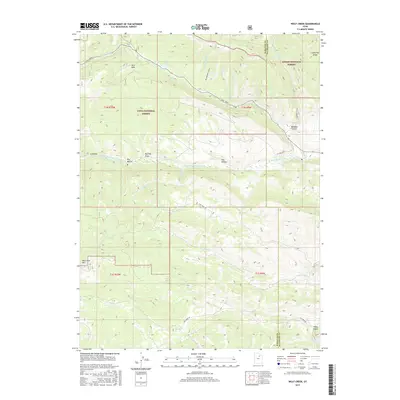
2017 Map of Wolf Creek
USGS Topo · Published 2017About this map
Wolf Creek winds through the high alpine border of Ashley National Forest and Uinta National Forest in this 2017 study of the Utah high country. This terrain is defined by a series of steep drainage systems and prominent landmarks like Lightning Ridge and Red Creek Mtn. The hydrology is particularly well-documented, showing the convergence of several mountain streams including Buckboard Cr, W Twin Cr, and Annie Mae Cr as they feed into larger systems. Evidence of historical land use and early ranching or travel is found in named geographical features like Tims Hole, Tabby Swale, and Buckley Draw. The W Fork Duchesne River cuts through the central portion of the sheet, served by primitive routes such as Sand Creek Rd and Red Creek Rd, which provide access to this undeveloped landscape.
Find a feature on this map
34 named features on this map. Tap any name to fly to it.
Don’t see what you’re looking for? This feature index may not catch every label — zoom into the map to look around manually.
Map Details
Editions of this 2017 Wolf Creek Map
This is the sole edition of this map. No revisions or reprints were ever made.
Other maps of this area

1885 · Salt Lake
USGS Topo · 1:250,000

1885 · Uinta
USGS Topo · 1:250,000

1900 · Coalville
USGS Topo · 1:125,000

1901 · Hayden Peak
USGS Topo · 1:125,000

1903 · Hayden Peak
USGS Topo · 1:125,000

1903 · Coalville
USGS Topo · 1:125,000

1907 · Strawberry Valley
USGS Topo · 1:125,000

1909 · Strawberry Valley
USGS Topo · 1:125,000

1954 · Salt Lake City
USGS Topo · 1:250,000

1958 · Salt Lake City
USGS Topo · 1:250,000