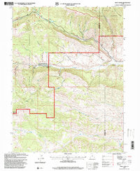
1996 Map of Wolf Creek
USGS Topo · Published 2000About this map
Ashley National Forest and Uinta National Forest converge in this high-elevation landscape, where the administrative boundaries of the Heber Ranger District and Duchesne Ranger District meet the Wasatch and Duchesne county line. The terrain is defined by a series of deep drainages and ridges, including the prominent Lightning Ridge and Rhodes Canyon in the northeast. Water management and livestock operations are evident through the presence of several Gaging Stations and Corrals positioned near the headwaters of the West Fork Duchesne River and East Fork Duchesne River. The map highlights a network of forest service roads and trails that navigate complex topography like Buckley Draw and Hay Hollow, providing a detailed look at the resource-based infrastructure of the late twentieth-century mountain west.
Find a feature on this map
20 named features on this map. Tap any name to fly to it.
Don’t see what you’re looking for? This feature index may not catch every label — zoom into the map to look around manually.
Map Details
Editions of this 1996 Wolf Creek Map
This is the sole edition of this map. No revisions or reprints were ever made.
Other maps of this area

1885 · Salt Lake
USGS Topo · 1:250,000

1885 · Uinta
USGS Topo · 1:250,000

1900 · Coalville
USGS Topo · 1:125,000

1901 · Hayden Peak
USGS Topo · 1:125,000

1903 · Hayden Peak
USGS Topo · 1:125,000

1903 · Coalville
USGS Topo · 1:125,000

1907 · Strawberry Valley
USGS Topo · 1:125,000

1909 · Strawberry Valley
USGS Topo · 1:125,000

1954 · Salt Lake City
USGS Topo · 1:250,000

1958 · Salt Lake City
USGS Topo · 1:250,000