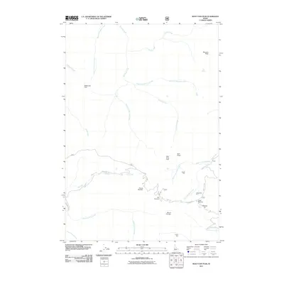
2011 Map of Wolf Fang Peak
USGS Topo · Published 2011About this map
Wolf Fang Peak and the nearby Wolf Fangs dominate this Idaho County landscape, which is defined by an intricate network of high-elevation drainages including Wolf Fang Creek and Porphyry Creek. The map documents a rugged interior where early 21st-century topography is shaped by both natural features and historic mining operations. Evidence of mineral exploration and extraction is scattered throughout the terrain, most notably at the McCrae Mine, Independence Mine, and the Goldman Cut near Fawn Meadow. The Elk Summit Rd serves as the primary artery through this wilderness, crossing Elk Summit and connecting isolated points like Round Meadow. This survey provides a precise look at the drainage patterns of the Salmon River mountains, capturing the headwaters of numerous creeks such as Middle Fork Smith Creek and West Fork Porphyry Creek.
Find a feature on this map
29 named features on this map. Tap any name to fly to it.
Don’t see what you’re looking for? This feature index may not catch every label — zoom into the map to look around manually.
Map Details
Editions of this 2011 Wolf Fang Peak Map
This is the sole edition of this map. No revisions or reprints were ever made.
Other maps of this area

1937 · Big Creek
USGS Topo · 1:48,000

1942 · Big Creek
USGS Topo · 1:62,500

1956 · Warren
USGS Topo · 1:62,500

1956 · Elk City
USGS Topo · 1:250,000

1960 · Elk City
USGS Topo · 1:250,000

1969 · Edwardsburg
USGS Topo · 1:24,000

1969 · Profile Gap
USGS Topo · 1:24,000

1969 · Parks Peak
USGS Topo · 1:24,000

1969 · Wolf Fang Peak
USGS Topo · 1:24,000

1969 · Big Creek
USGS Topo · 1:24,000