
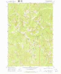
1969 Map of Profile Gap
USGS Topo · Published 1971About this map
Moscow Mine and Glasgow Mine anchor the northern reaches of this high-elevation terrain, illustrating the concentrated mining activity within the Payette National Forest. This 1969 field-checked survey reveals a landscape where industrial extraction and natural features are tightly entwined, particularly around Profile Gap. A network of pack trails and jeep trails provides the only access through the steep drainages of Logan Creek and the South Fork Elk Creek, connecting several remote claims such as the Red Metals Mine and Lotspeich Mine. The topography is defined by prominent summits like Dixie Mtn and Willson Peak, while alpine waters including Crater Lake and Fish Lake are tucked into the high ridges. This map documents a specific era of mountain resource extraction and the established backcountry trail systems used to navigate the Quartz Ridge.
Find a feature on this map
40 named features on this map. Tap any name to fly to it.
Don’t see what you’re looking for? This feature index may not catch every label — zoom into the map to look around manually.
Map Details
Editions of this 1969 Profile Gap Map
2 editions found
Other maps of this area

1937 · Yellow Pine
USGS Topo · 1:48,000

1937 · Big Creek
USGS Topo · 1:48,000

1942 · Big Creek
USGS Topo · 1:62,500

1943 · Yellow Pine
USGS Topo · 1:62,500

1956 · Elk City
USGS Topo · 1:250,000

1957 · Challis
USGS Topo · 1:250,000

1960 · Elk City
USGS Topo · 1:250,000

1960 · Challis
USGS Topo · 1:250,000

1963 · Challis
USGS Topo · 1:250,000

1969 · Edwardsburg
USGS Topo · 1:24,000