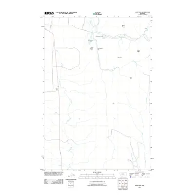
2011 Map of Wolf Hill
USGS Topo · Published 2011About this map
Sixteenmile Creek winds through this cattle-country landscape, where small-scale water management defines the local geography. Several earthen structures, including Kiff Reservoir 1 Dam and Lucas Number 2 Dam, are situated along the drainage systems of Cottonwood Creek and its tributaries, supporting the ranching operations that anchor the region. The topography is shaped by the Rees Hills and the namesake Wolf Hill, rising above the seasonal watercourses of Potter Creek and Cole Creek. Named homesteads and holdings such as Staley Place, Arthur Ranch, and Gjerde Ranch offer a specific view of modern land ownership and rural settlement patterns in Meagher County. The network of local routes like Coal Camp Rd and Lincoln Rd provides the primary access through this open ranch land.
Find a feature on this map
23 named features on this map. Tap any name to fly to it.
Don’t see what you’re looking for? This feature index may not catch every label — zoom into the map to look around manually.
Map Details
Editions of this 2011 Wolf Hill Map
This is the sole edition of this map. No revisions or reprints were ever made.
Other maps of this area

1886 · Little Belt Mts.
USGS Topo · 1:250,000

1894 · Little Belt Mts.
USGS Topo · 1:250,000

1897 · Little Belt Mts.
USGS Topo · 1:250,000

1898 · Little Belt Mts.
USGS Topo · 1:250,000

1902 · Little Belt Mts.
USGS Topo · 1:250,000

1948 · White Sulphur Springs
USGS Topo · 1:250,000

1951 · Sixteen NE
USGS Topo · 1:24,000
1951 · Wallrock
USGS Topo · 1:24,000

1951 · Hamen
USGS Topo · 1:24,000
1951 · Wolf Hill
USGS Topo · 1:24,000