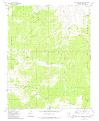
1979 Map of Wolf Hole Mtn. West
USGS Topo · Published 1980About this map
Wolf Hole Mountain and the high desert terrain of the Arizona Strip are meticulously detailed in this late-1970s survey. The landscape is defined by its vital water sources, including numerous isolated springs and constructed features like Low Mountain Reservoir, Maple Reservoir, and Larson Tank. These features, along with a network of Pack Trails and Jeep Trails, reflect the region's history of cattle ranching and wilderness navigation.
Find a feature on this map
31 named features on this map. Tap any name to fly to it.
Don’t see what you’re looking for? This feature index may not catch every label — zoom into the map to look around manually.
Map Details
Editions of this 1979 Wolf Hole Mtn. West Map
2 editions found
Other maps of this area

1886 · Mt. Trumbull
USGS Topo · 1:250,000

1892 · Mt. Trumbull
USGS Topo · 1:250,000

1953 · Grand Canyon
USGS Topo · 1:250,000

1954 · Wolf Hole Mtn. NW
USGS Topo · 1:24,000

1954 · Wolf Hole Mtn. NE
USGS Topo · 1:24,000

1954 · Littlefield 3 NE
USGS Topo · 1:24,000

1954 · Littlefield
USGS Topo · 1:62,500

1954 · Cane Springs
USGS Topo · 1:62,500

1957 · Grand Canyon
USGS Topo · 1:250,000

1958 · Grand Canyon
USGS Topo · 1:250,000