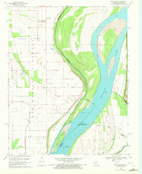
1969 Map of Wolf Island
USGS Topo · Published 1972About this map
The Mississippi River creates a dynamic border between Missouri and Kentucky in this late-1960s survey, where the river's shifting path is marked by features like Middle Bar and Medley Bar. The landscape is dominated by the Wolf Island Floodway, a massive engineering feature designed to manage the river's seasonal volatility. Within this low-lying region, small pockets of history remain at Wolf Island, where the Ivie Cem and nearby Mt Zion Ch serve as anchors for local genealogy. To the west, Towosahgy State Park preserves important cultural ground, while the eastern bank is defined by the elevation of Chalk Bluff and Three Ponds Bluff. This map captures a rural riverfront economy defined by drainage and flood control, evidenced by the extensive levee systems protecting James Bayou and the surrounding farmland.
Find a feature on this map
23 named features on this map. Tap any name to fly to it.
Don’t see what you’re looking for? This feature index may not catch every label — zoom into the map to look around manually.
Map Details
Editions of this 1969 Wolf Island Map
2 editions found
Other maps of this area

1939 · Wickliffe
USGS Topo · 1:62,500

1939 · Charleston
USGS Topo · 1:62,500

1939 · Hickman
USGS Topo · 1:62,500

1939 · Bayouville
USGS Topo · 1:62,500

1951 · Cayce
USGS Topo · 1:24,000

1951 · Bondurant
USGS Topo · 1:24,000

1951 · Oakton
USGS Topo · 1:24,000

1951 · Hickman
USGS Topo · 1:24,000

1951 · Wolf Island
USGS Topo · 1:24,000

1951 · Wickliffe SW
USGS Topo · 1:24,000