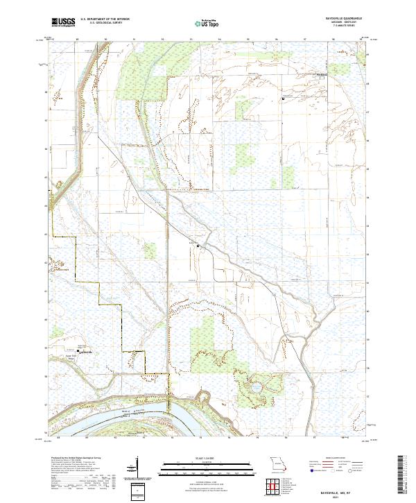
2021 Map of Bayouville
USGS Topo · Published 2021About this map
The Mississippi River defines the western edge of this landscape, where the state boundary between Missouri and Kentucky follows the historic Bend of Island Number 8. This riverine environment is characterized by an extensive network of drainage features such as the Saint Johns Diversion Ditch, Spillway Ditch, and Wilkerson Ditch, which manage water across the low-lying terrain. These engineered waterways sit alongside natural features like Big Oak Lake and Sixmile Ponds, illustrating the long-standing effort to utilize the fertile bottomlands.
Find a feature on this map
45 named features on this map. Tap any name to fly to it.
Don’t see what you’re looking for? This feature index may not catch every label — zoom into the map to look around manually.
Map Details
Editions of this 2021 Bayouville Map
This is the sole edition of this map. No revisions or reprints were ever made.
Other maps of this area

1939 · Wickliffe
USGS Topo · 1:62,500

1939 · Charleston
USGS Topo · 1:62,500

1939 · Hickman
USGS Topo · 1:62,500

1939 · Bayouville
USGS Topo · 1:62,500

1951 · Bondurant
USGS Topo · 1:24,000

1951 · Hickman
USGS Topo · 1:24,000

1951 · Wolf Island
USGS Topo · 1:24,000

1951 · Wickliffe SW
USGS Topo · 1:24,000

1951 · Hubbard Lake
USGS Topo · 1:24,000

1952 · Wickliffe
USGS Topo · 1:62,500