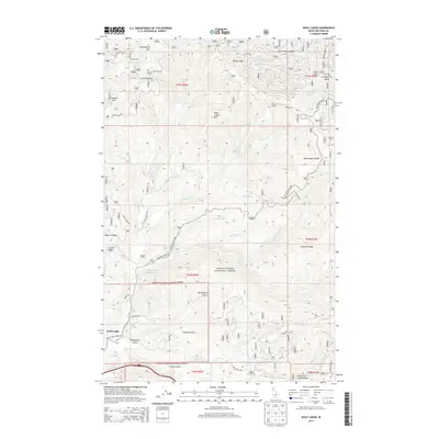
2014 Map of Wolf Lodge
USGS Topo · Published 2014About this map
Coeur d'Alene National Forest encompasses the vast majority of this landscape, where the confluence of Wolf Lodge Creek and its many tributaries define the local geography. The small settlement of Wolf Lodge serves as a western anchor near the junction of several forest access routes, including S Wolf Lodge Creek Rd and S Blue Creek Rd. Higher elevations are marked by significant landmarks like Wolf Lodge Mtn, Treasure Mtn, and the Fourth of July Summit to the southeast. The drainage network is particularly dense here, featuring named waterways such as Stella Creek, Marie Creek, and Skitwish Creek. This 2014 survey documents the complex system of forest development roads, including the aptly named Lost Mines Rd near Fernan Saddle, which hints at the region's historic prospecting activity and resource management within the national forest boundaries.
Find a feature on this map
55 named features on this map. Tap any name to fly to it.
Don’t see what you’re looking for? This feature index may not catch every label — zoom into the map to look around manually.
Map Details
Editions of this 2014 Wolf Lodge Map
This is the sole edition of this map. No revisions or reprints were ever made.
Other maps of this area

1903 · Rathdrum
USGS Topo · 1:125,000

1909 · Cataldo
USGS Topo · 1:125,000

1911 · Cataldo
USGS Topo · 1:125,000

1955 · Spokane
USGS Topo · 1:250,000

1957 · Kingston
USGS Topo · 1:62,500

1957 · Lane
USGS Topo · 1:62,500

1958 · Spokane
USGS Topo · 1:250,000

1961 · Lakeview
USGS Topo · 1:62,500

1961 · Athol
USGS Topo · 1:62,500

1961 · Hayden Lake
USGS Topo · 1:24,000