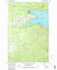
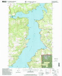
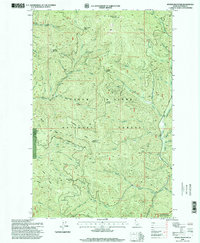
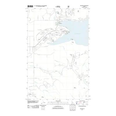
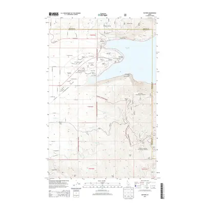
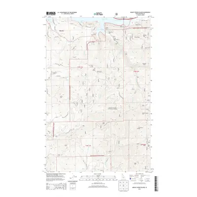
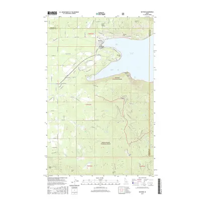
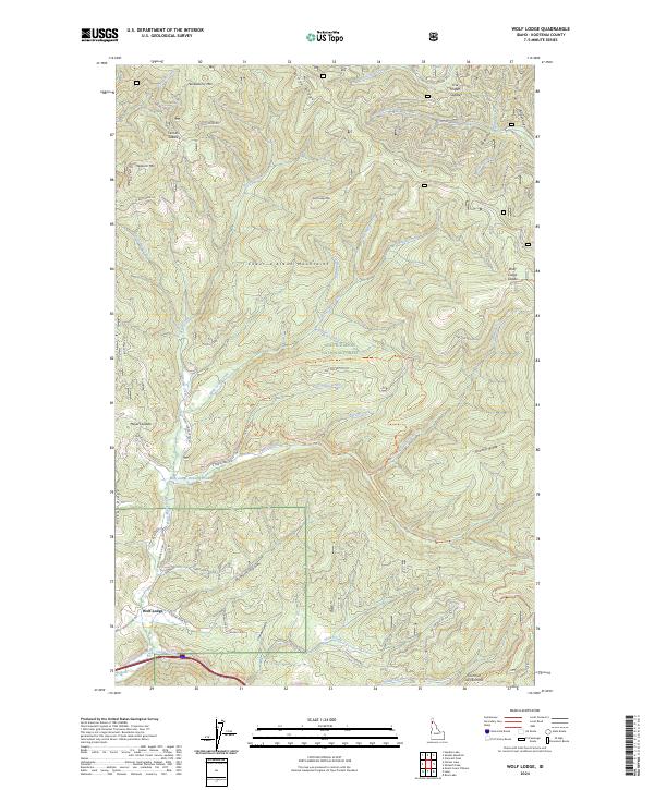
1982 Map of Wolf Lodge
USGS Topo · Published 1982About this map
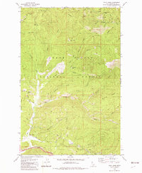
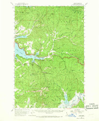
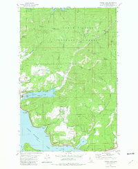
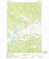
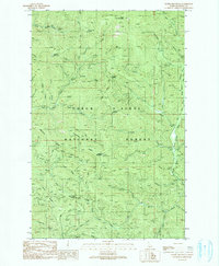
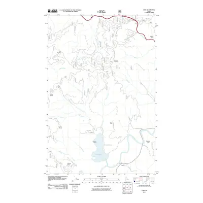
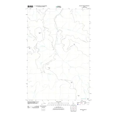
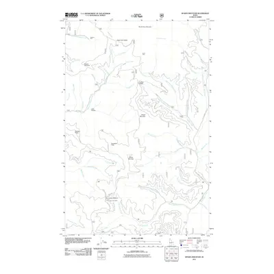
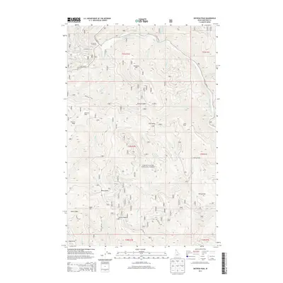
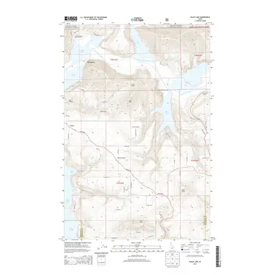
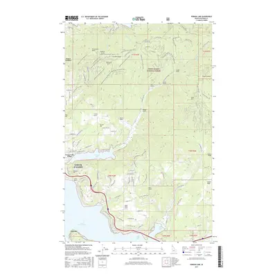
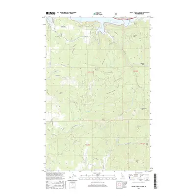
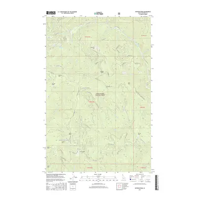
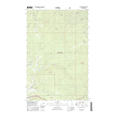
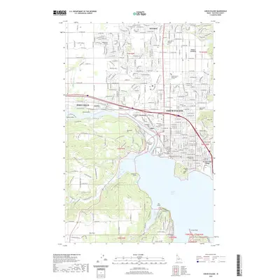
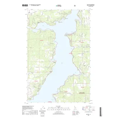
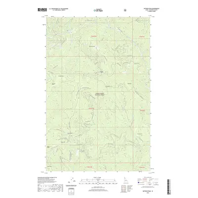
Coeur d'Alene National Forest dominates this mountain landscape, defined by a network of ridges and drainages during the early 1980s. The small settlement of Wolf Lodge serves as the primary point of human activity near the confluence of Wolf Lodge Creek and its southern tributaries. The map documents an area where resource extraction and backcountry access are central, evidenced by the Homebuilder Mine and numerous 4WD trails winding through the timber. Distinctive high points like Wolf Lodge Mtn, Treasure Mtn, and Huckleberry Mtn form a series of summits connected by notable gaps such as Meyers Saddle and Fernan Saddle. A network of creeks, including Skitwish Creek, Marie Creek, and Deception Creek, carves through the terrain, illustrating the complex water system that feeds the region's larger basins. A prominent Pipeline corridor and the presence of Cabin Lane indicate the infrastructure required to manage these remote Idaho reaches.
Find a feature on this map
35 named features on this map. Tap any name to fly to it.
Don’t see what you’re looking for? This feature index may not catch every label — zoom into the map to look around manually.
Map Details
Editions of this 1982 Wolf Lodge Map
This is the sole edition of this map. No revisions or reprints were ever made.
Historical Maps of Wolf Lodge Through Time
132 maps found
1950 Rochat Peak
Kootenai County, ID

1952 Rochat Peak
Kootenai County, ID
1957 Coeur D'Alene
Kootenai County, ID
1957 Kingston
Kootenai County, ID
1957 Lane
Kootenai County, ID

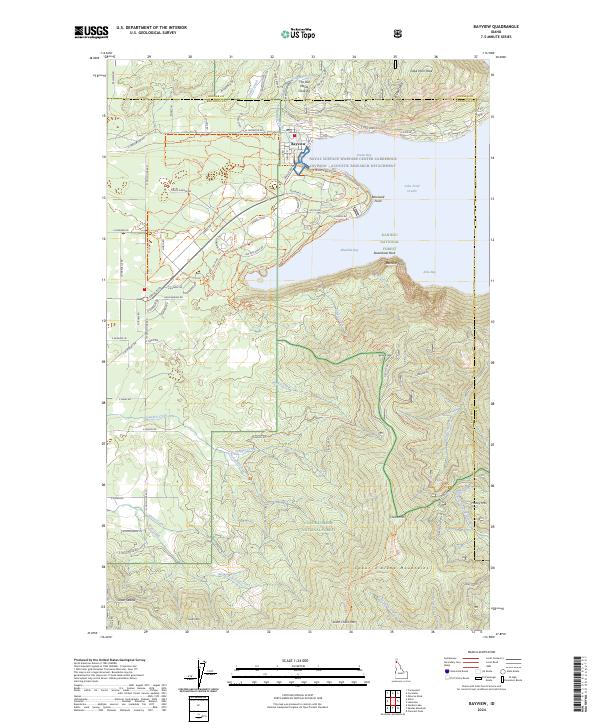
1961 Bayview
Kootenai County, ID
1961 Lakeview
Kootenai County, ID
1961 Spirit Lake East
Kootenai County, ID
1961 Spirit Lake West
Kootenai County, ID
1967 Bayview
Kootenai County, ID

1975 Coeur D'Alene NW
Kootenai County, ID
1975 Coeur D'Alene SE
Kootenai County, ID

1975 Lane NW
Kootenai County, ID
1975 Lane SW
Kootenai County, ID

1975 Plummer NE
Kootenai County, ID
1975 Plummer NW
Kootenai County, ID

1980 Setters
Kootenai County, ID

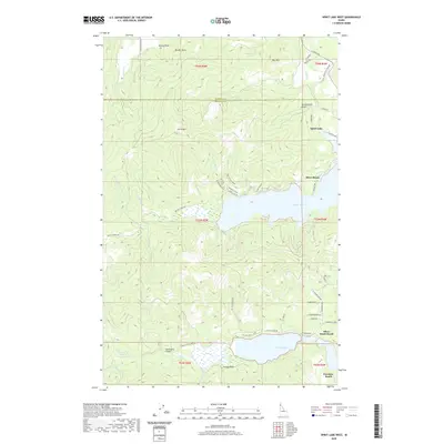
1981 Black Lake
Kootenai County, ID

1981 Coeur D'Alene
Kootenai County, ID
1981 Fernan Lake
Kootenai County, ID
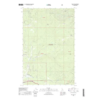
1981 Lane
Kootenai County, ID

1981 Medimont
Kootenai County, ID
1981 Mica Bay
Kootenai County, ID
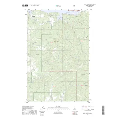
1981 Mount Coeur D'Alene
Kootenai County, ID
1982 Wolf Lodge
Kootenai County, ID
1985 Rose Lake
Kootenai County, ID
1985 Skitwish Peak
Kootenai County, ID
1987 Coeur D'Alene
Kootenai County, ID
1990 Cataract Peak
Kootenai County, ID
1990 Spades Mountain
Kootenai County, ID

1996 Bayview
Kootenai County, ID
1996 Black Lake
Kootenai County, ID
1996 Cataract Peak
Kootenai County, ID

1996 Coeur D'Alene
Kootenai County, ID

1996 Fernan Lake
Kootenai County, ID
1996 Lane
Kootenai County, ID

1996 Medimont
Kootenai County, ID
1996 Mica Bay
Kootenai County, ID

1996 Mount Coeur D'Alene
Kootenai County, ID
1996 Rochat Peak
Kootenai County, ID
1996 Rose Lake
Kootenai County, ID
1996 Skitwish Peak
Kootenai County, ID
1996 Spades Mountain
Kootenai County, ID
1996 Spirit Lake East
Kootenai County, ID
1996 Spirit Lake West
Kootenai County, ID
1996 Wolf Lodge
Kootenai County, ID
2011 Bayview
Kootenai County, ID
2011 Black Lake
Kootenai County, ID
2011 Cataract Peak
Kootenai County, ID

2011 Coeur D'Alene
Kootenai County, ID
2011 Fernan Lake
Kootenai County, ID
2011 Lane
Kootenai County, ID
2011 Medimont
Kootenai County, ID
2011 Mica Bay
Kootenai County, ID
2011 Mount Coeur D'Alene
Kootenai County, ID
2011 Rochat Peak
Kootenai County, ID
2011 Rose Lake
Kootenai County, ID
2011 Setters
Kootenai County, ID
2011 Skitwish Peak
Kootenai County, ID
2011 Spades Mountain
Kootenai County, ID
2011 Spirit Lake East
Kootenai County, ID
2011 Spirit Lake West
Kootenai County, ID
2011 Wolf Lodge
Kootenai County, ID
2013 Bayview
Kootenai County, ID
2013 Cataract Peak
Kootenai County, ID

2013 Coeur D'Alene
Kootenai County, ID
2013 Fernan Lake
Kootenai County, ID
2013 Mica Bay
Kootenai County, ID
2013 Mount Coeur D'Alene
Kootenai County, ID
2013 Rochat Peak
Kootenai County, ID
2013 Rose Lake
Kootenai County, ID
2013 Setters
Kootenai County, ID
2013 Skitwish Peak
Kootenai County, ID
2013 Spades Mountain
Kootenai County, ID
2013 Spirit Lake East
Kootenai County, ID
2013 Spirit Lake West
Kootenai County, ID
2014 Black Lake
Kootenai County, ID
2014 Lane
Kootenai County, ID
2014 Medimont
Kootenai County, ID
2014 Wolf Lodge
Kootenai County, ID
2017 Bayview
Kootenai County, ID
2017 Black Lake
Kootenai County, ID
2017 Cataract Peak
Kootenai County, ID
2017 Coeur D'Alene
Kootenai County, ID
2017 Fernan Lake
Kootenai County, ID
2017 Lane
Kootenai County, ID
2017 Medimont
Kootenai County, ID
2017 Mica Bay
Kootenai County, ID
2017 Mount Coeur D'Alene
Kootenai County, ID
2017 Rochat Peak
Kootenai County, ID
2017 Rose Lake
Kootenai County, ID
2017 Setters
Kootenai County, ID
2017 Skitwish Peak
Kootenai County, ID
2017 Spades Mountain
Kootenai County, ID
2017 Spirit Lake East
Kootenai County, ID
2017 Spirit Lake West
Kootenai County, ID
2017 Wolf Lodge
Kootenai County, ID
2020 Bayview
Kootenai County, ID
2020 Black Lake
Kootenai County, ID
2020 Cataract Peak
Kootenai County, ID
2020 Coeur D'Alene
Kootenai County, ID
2020 Fernan Lake
Kootenai County, ID
2020 Lane
Kootenai County, ID
2020 Medimont
Kootenai County, ID
2020 Mica Bay
Kootenai County, ID
2020 Mount Coeur D'Alene
Kootenai County, ID
2020 Rochat Peak
Kootenai County, ID
2020 Rose Lake
Kootenai County, ID
2020 Setters
Kootenai County, ID
2020 Skitwish Peak
Kootenai County, ID
2020 Spades Mountain
Kootenai County, ID
2020 Spirit Lake East
Kootenai County, ID
2020 Spirit Lake West
Kootenai County, ID
2020 Wolf Lodge
Kootenai County, ID
2023 Mount Coeur D'Alene
Kootenai County, ID
2024 Bayview
Kootenai County, ID
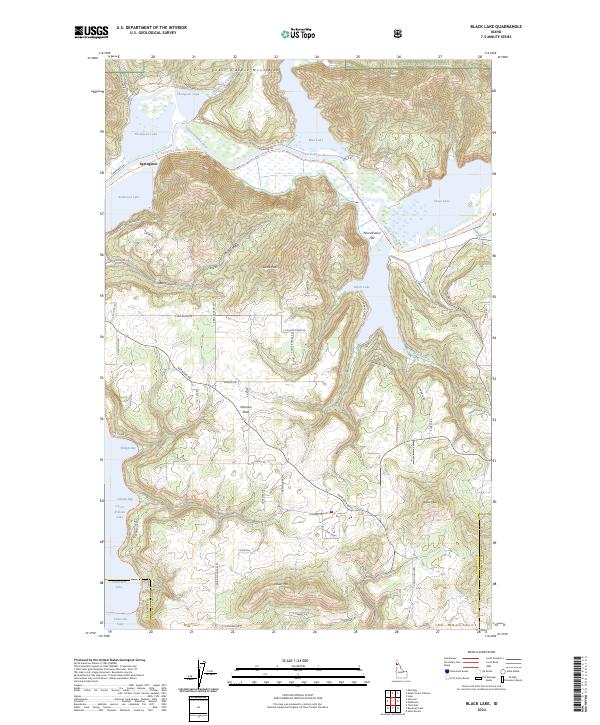
2024 Black Lake
Kootenai County, ID
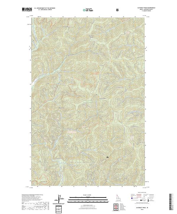
2024 Cataract Peak
Kootenai County, ID

2024 Coeur D'Alene
Kootenai County, ID
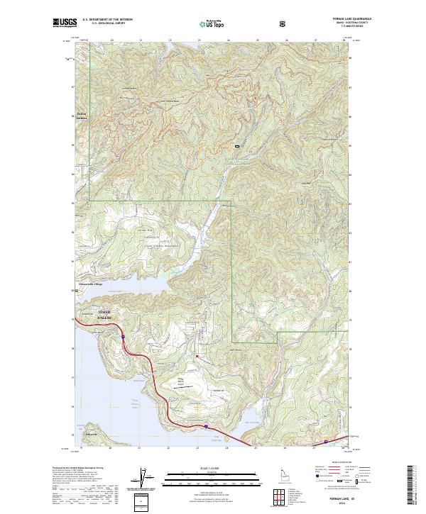
2024 Fernan Lake
Kootenai County, ID
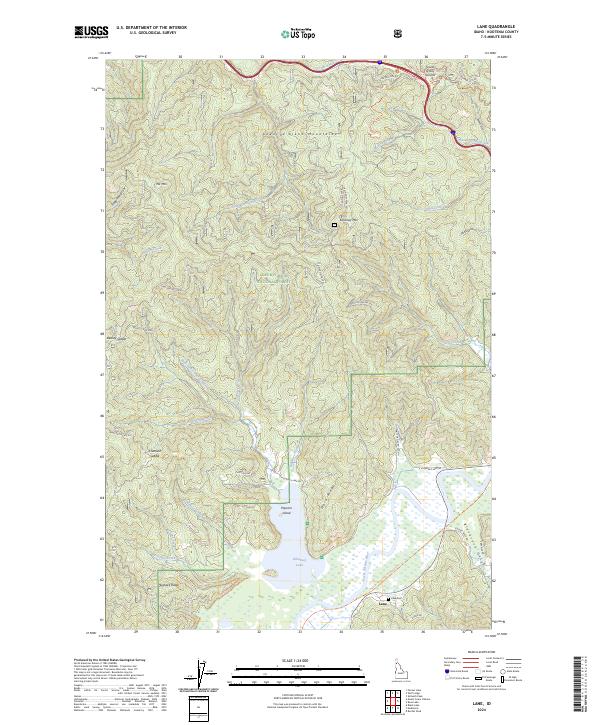
2024 Lane
Kootenai County, ID
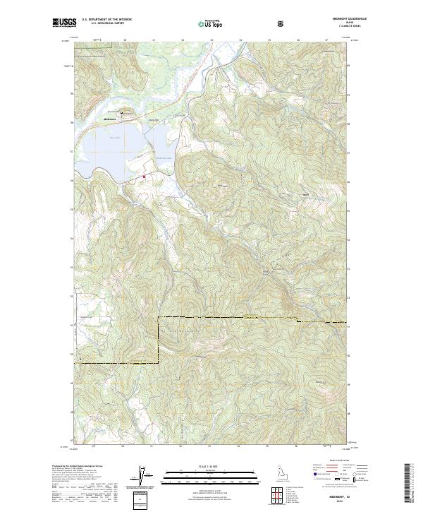
2024 Medimont
Kootenai County, ID
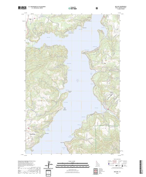
2024 Mica Bay
Kootenai County, ID
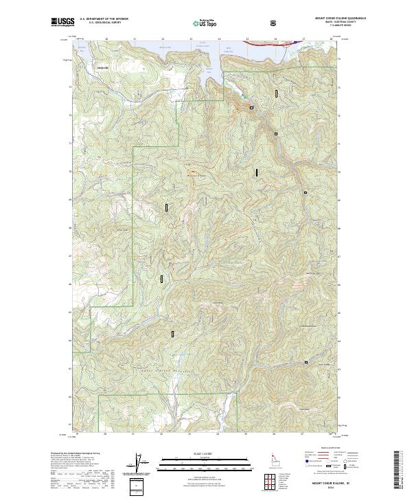
2024 Mount Coeur D'Alene
Kootenai County, ID
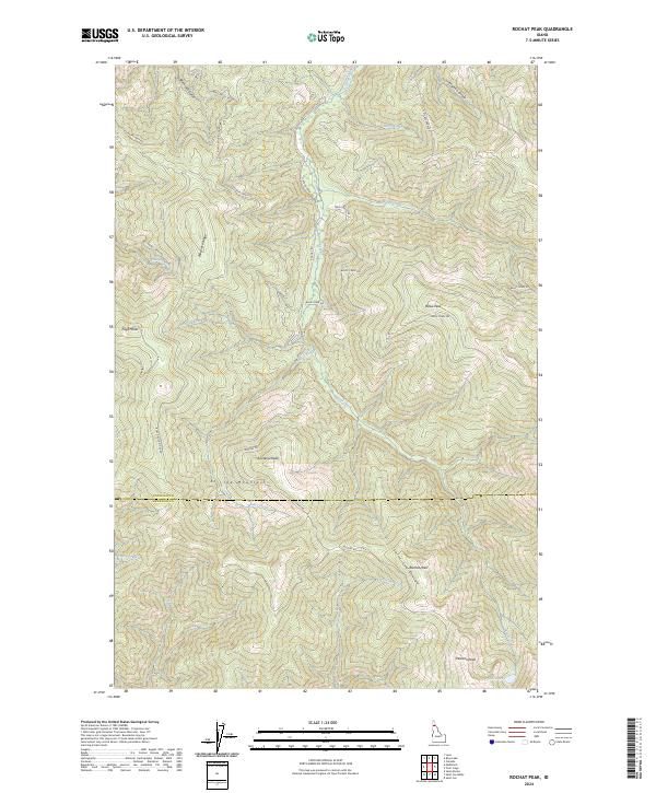
2024 Rochat Peak
Kootenai County, ID
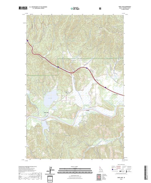
2024 Rose Lake
Kootenai County, ID
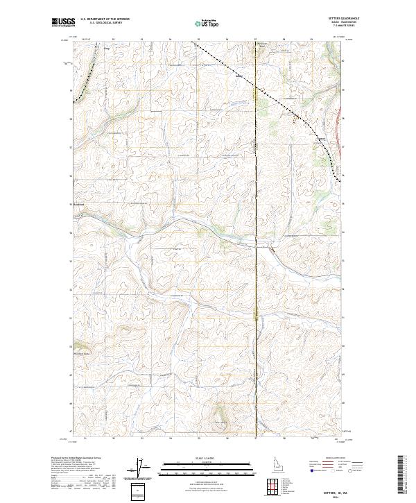
2024 Setters
Kootenai County, ID
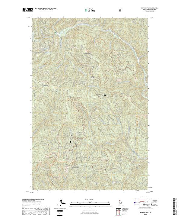
2024 Skitwish Peak
Kootenai County, ID
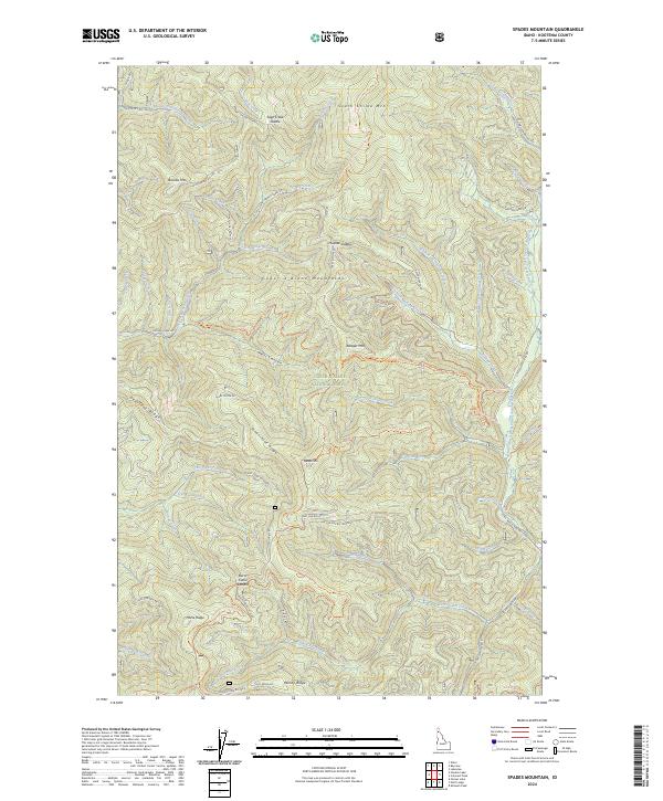
2024 Spades Mountain
Kootenai County, ID
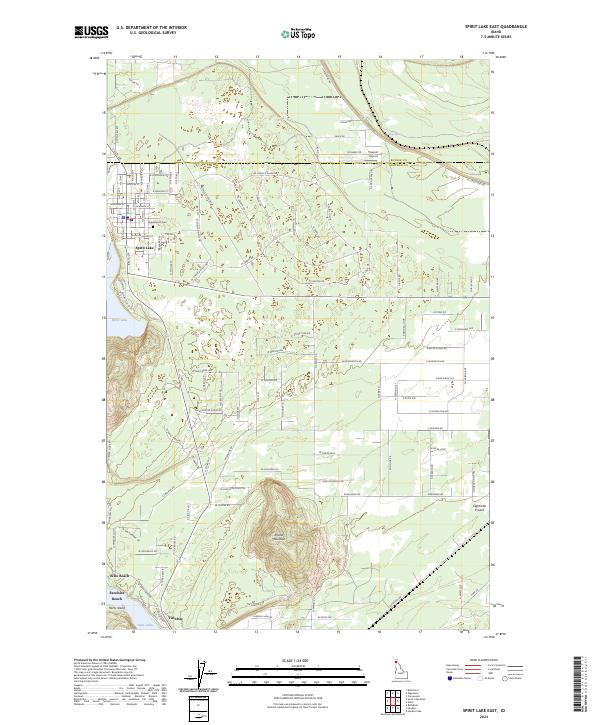
2024 Spirit Lake East
Kootenai County, ID
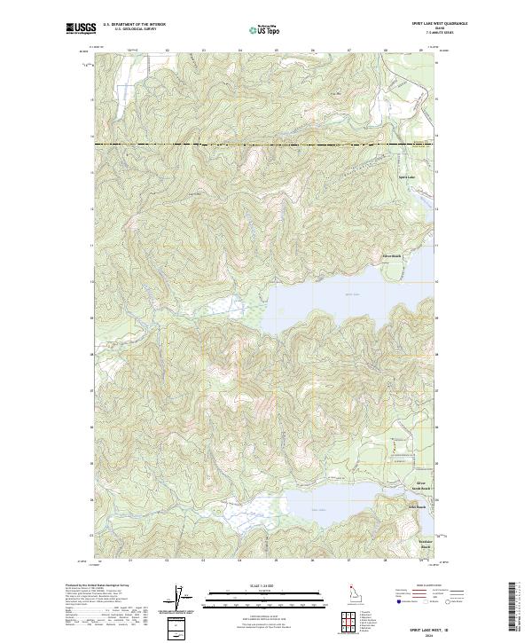
2024 Spirit Lake West
Kootenai County, ID
2024 Wolf Lodge
Kootenai County, ID