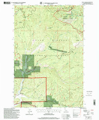
1996 Map of Wolf Lodge
USGS Topo · Published 1999About this map
Wolf Lodge Mountain and the surrounding drainages of the Coeur d'Alene National Forest dominate this mid-1990s topographic study. The landscape is defined by steep ridges and complex creek systems, including Wolf Lodge Creek and Marie Creek, which carve through the high elevations of Huckleberry Mountain and Skitwish Ridge. The map reveals the managed character of the timberlands, highlighting the Deception Creek Experimental Forest and several extraction sites. Resource history is anchored by the Homebuilder Mine and a Gravel Pit, while the small settlement of Wolf Lodge sits at the nexus of the valley floor. Transportation is limited to forest roads and trails connecting landmarks like Meyers Saddle and Five Fingers Saddle, illustrating the area's role as a working forest landscape.
Find a feature on this map
38 named features on this map. Tap any name to fly to it.
Don’t see what you’re looking for? This feature index may not catch every label — zoom into the map to look around manually.
Map Details
Editions of this 1996 Wolf Lodge Map
This is the sole edition of this map. No revisions or reprints were ever made.
Other maps of this area

1903 · Rathdrum
USGS Topo · 1:125,000

1909 · Cataldo
USGS Topo · 1:125,000

1911 · Cataldo
USGS Topo · 1:125,000

1955 · Spokane
USGS Topo · 1:250,000

1957 · Kingston
USGS Topo · 1:62,500

1957 · Lane
USGS Topo · 1:62,500

1958 · Spokane
USGS Topo · 1:250,000

1961 · Lakeview
USGS Topo · 1:62,500

1961 · Athol
USGS Topo · 1:62,500

1961 · Hayden Lake
USGS Topo · 1:24,000