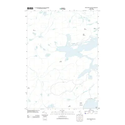
2013 Map of Wolf Mountain
USGS Topo · Published 2013About this map
Nehasane and the surrounding wilderness of the Adirondack highlands are the focus of this survey, which details a landscape defined by an intricate network of remote water bodies and prominent summits. The southern portion of the sheet is anchored by Frederica Mountain overlooking Lake Lila, while the Oswegatchie River meanders through the western terrain. The geography is characterized by numerous glacial ponds and high points, such as Wolf Mountain and Cat Mountain, which dominate the central and northern elevations.
Find a feature on this map
51 named features on this map. Tap any name to fly to it.
Don’t see what you’re looking for? This feature index may not catch every label — zoom into the map to look around manually.
Map Details
Editions of this 2013 Wolf Mountain Map
This is the sole edition of this map. No revisions or reprints were ever made.
Other maps of this area

1903 · Big Moose
USGS Topo · 1:62,500

1903 · Raquette Lake
USGS Topo · 1:62,500

1907 · Tupper Lake
USGS Topo · 1:62,500

1919 · Cranberry Lake
USGS Topo · 1:62,500

1921 · Cranberry Lake
USGS Topo · 1:62,500

1931 · Cranberry Lake
USGS Topo · 1:62,500

1948 · Ogdensburg
USGS Topo · 1:250,000

1950 · Utica
USGS Topo · 1:250,000

1951 · Ogdensburg
USGS Topo · 1:250,000

1953 · Ogdensburg
USGS Topo · 1:250,000