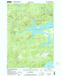
1999 Map of Wolf Mountain
USGS Topo · Published 2001About this map
Lows Lake and Bog Lake dominate this portion of the Adirondack State Park, representing a landscape defined by expansive water bodies and extensive wetlands. The terrain is punctuated by isolated peaks including Wolf Mountain and Cat Mtn, the latter featuring a Lookout Tower overlooking a dense network of remote ponds such as Olmstead Pond and Cowhorn Pond. This survey captures the wilderness character of the State Forest Preserve at the intersection of St. Lawrence, Herkimer, and Hamilton counties.
Find a feature on this map
64 named features on this map. Tap any name to fly to it.
Don’t see what you’re looking for? This feature index may not catch every label — zoom into the map to look around manually.
Map Details
Editions of this 1999 Wolf Mountain Map
This is the sole edition of this map. No revisions or reprints were ever made.
Other maps of this area

1903 · Big Moose
USGS Topo · 1:62,500

1903 · Raquette Lake
USGS Topo · 1:62,500

1907 · Tupper Lake
USGS Topo · 1:62,500

1919 · Cranberry Lake
USGS Topo · 1:62,500

1921 · Cranberry Lake
USGS Topo · 1:62,500

1931 · Cranberry Lake
USGS Topo · 1:62,500

1948 · Ogdensburg
USGS Topo · 1:250,000

1950 · Utica
USGS Topo · 1:250,000

1951 · Ogdensburg
USGS Topo · 1:250,000

1953 · Ogdensburg
USGS Topo · 1:250,000