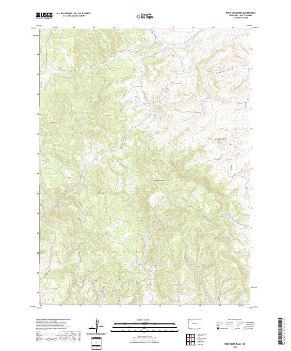
2022 Map of Wolf Mountain
USGS Topo · Published 2022About this map
Wolf Mtn and Slippery Sides Mtn dominate this high-elevation landscape in northwest Colorado, where a complex network of gulches and creeks carves through the terrain. The map reveals a remote area characterized by significant geological landmarks like Rattlesnake Butte and Sand Mtn, alongside more localized features such as Butcherknife Gulch and McCrosky Gulch. A series of county roads, including Co RD 56 and Co RD 50, wind through the drainages of Deep Cr and Tow Cr, following the natural contours of the land. In the southern portion of the quadrangle, the presence of Hill N Dale and the Canyon View Trl indicates areas of more recent rural development or recreation, contrasting with the primary drainage patterns of Georges Gulch and Farnsworth Cr.
Find a feature on this map
42 named features on this map. Tap any name to fly to it.
Don’t see what you’re looking for? This feature index may not catch every label — zoom into the map to look around manually.
Map Details
Editions of this 2022 Wolf Mountain Map
This is the sole edition of this map. No revisions or reprints were ever made.
Other maps of this area

1911 · Hahns Peak
USGS Topo · 1:125,000

1913 · Hahns Peak
USGS Topo · 1:125,000

1923 · Pilot Knob
USGS Topo · 1:62,500

1924 · Mt. Harris
USGS Topo · 1:48,000

1925 · Pilot Knob
USGS Topo · 1:62,500

1926 · Mount Harris
USGS Topo · 1:62,500

1954 · Craig
USGS Topo · 1:250,000

1957 · Craig
USGS Topo · 1:250,000

1958 · Craig
USGS Topo · 1:250,000

1960 · Craig
USGS Topo · 1:250,000