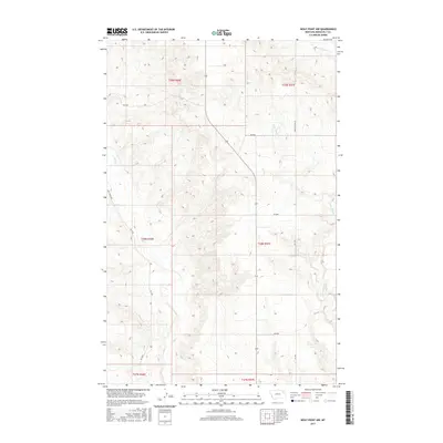
2017 Map of Wolf Point NW
USGS Topo · Published 2017About this map
Wolf Creek and its tributaries carve a complex drainage pattern across this section of Roosevelt County, Montana. The landscape is defined by the sharp coulees and ridges typical of the high plains north of the Missouri River. A network of rural routes, including the prominent Powder River Rd and Wolf Creek Rd, provides the primary infrastructure through the region, following the natural contours of the land. In the northeast corner, W Fork Tule Cr drains toward the Tule Creek valley, while Little Wolf Cr meanders through the central and eastern portions of the quadrangle. This map reflects a sparsely settled ranching or agricultural environment, where the land is strictly organized by the Public Land Survey System, as evidenced by the clear township and range boundaries such as t29n r46e and t28n r47e.
Find a feature on this map
17 named features on this map. Tap any name to fly to it.
Don’t see what you’re looking for? This feature index may not catch every label — zoom into the map to look around manually.
Map Details
Editions of this 2017 Wolf Point NW Map
This is the sole edition of this map. No revisions or reprints were ever made.
Other maps of this area

1910 · Todd Lakes
USGS Topo · 1:62,500

1915 · Tule Valley
USGS Topo · 1:62,500

1915 · Oswego
USGS Topo · 1:62,500

1915 · Todd Lakes
USGS Topo · 1:62,500

1916 · Wolf Point
USGS Topo · 1:62,500

1954 · Wolf Point
USGS Topo · 1:250,000

1958 · Wolf Point
USGS Topo · 1:250,000

1972 · Flynn Creek North
USGS Topo · 1:24,000

1972 · Wolf Point
USGS Topo · 1:24,000

1972 · Macon
USGS Topo · 1:24,000