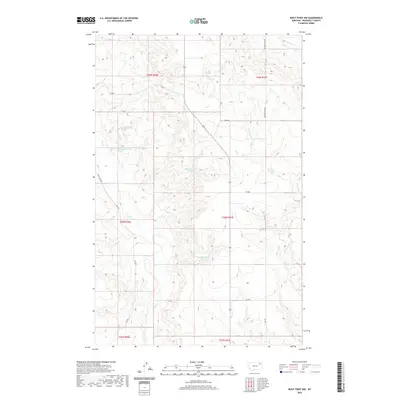
2020 Map of Wolf Point NW
USGS Topo · Published 2020About this map
Wolf Cr and its tributaries wind through this corner of the Missouri River plateau in Roosevelt County, Montana. The landscape is defined by the dendritic drainage patterns of Little Wolf Cr and the W Fork Tule Cr to the north, carving through high prairie terrain. This 2020 survey documents several remote water sources, including the 28N46E01CBBA02 Spring and 28N47E20CDCB01 Spring, which serve as vital landmarks in this arid ranching environment. The regional road network is sparse, centered on primary arteries like Powder River Rd and Rd 1074, which connect the scattered sections of the Public Land Survey System. These routes follow the natural topography of the coulees and ridges, reflecting the enduring land use patterns of the Big Sky Country.
Find a feature on this map
20 named features on this map. Tap any name to fly to it.
Don’t see what you’re looking for? This feature index may not catch every label — zoom into the map to look around manually.
Map Details
Editions of this 2020 Wolf Point NW Map
This is the sole edition of this map. No revisions or reprints were ever made.
Other maps of this area

1910 · Todd Lakes
USGS Topo · 1:62,500

1915 · Tule Valley
USGS Topo · 1:62,500

1915 · Oswego
USGS Topo · 1:62,500

1915 · Todd Lakes
USGS Topo · 1:62,500

1916 · Wolf Point
USGS Topo · 1:62,500

1954 · Wolf Point
USGS Topo · 1:250,000

1958 · Wolf Point
USGS Topo · 1:250,000

1972 · Flynn Creek North
USGS Topo · 1:24,000

1972 · Wolf Point
USGS Topo · 1:24,000

1972 · Macon
USGS Topo · 1:24,000