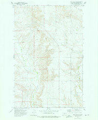
1972 Map of Wolf Point NW
USGS Topo · Published 1976About this map
Wolf Creek and Little Wolf Creek define this section of the Missouri River plateau within the Fort Peck Indian Reservation, as recorded in the early 1970s. The landscape is marked by the branching drainages of Tule Creek and numerous groundwater sources identified simply as Spring and Well. This era shows a land organized by the section lines of the public land survey system, with sparse industrial footprints like the Gravel Pits and Gravel Pit located in the northwest. Local infrastructure is minimal, represented by the West Fork No 2 site and a Radio Tower, reflecting the open, high-plains character of Roosevelt County before modern expansion. The map serves as a precise record of water access and topographical elevation in an area where such features were vital for ranching and local land management.
Find a feature on this map
9 named features on this map. Tap any name to fly to it.
Don’t see what you’re looking for? This feature index may not catch every label — zoom into the map to look around manually.
Map Details
Editions of this 1972 Wolf Point NW Map
This is the sole edition of this map. No revisions or reprints were ever made.
Other maps of this area

1910 · Todd Lakes
USGS Topo · 1:62,500

1915 · Tule Valley
USGS Topo · 1:62,500

1915 · Oswego
USGS Topo · 1:62,500

1915 · Todd Lakes
USGS Topo · 1:62,500

1916 · Wolf Point
USGS Topo · 1:62,500

1954 · Wolf Point
USGS Topo · 1:250,000

1958 · Wolf Point
USGS Topo · 1:250,000

1972 · Flynn Creek North
USGS Topo · 1:24,000

1972 · Wolf Point
USGS Topo · 1:24,000

1972 · Macon
USGS Topo · 1:24,000