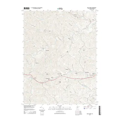
2014 Map of Wolf Summit
USGS Topo · Published 2014About this map
Wolf Summit sits along the southern corridor of this landscape, marking a concentration of activity where the topography gives way to the drainage of Simpson Fork and Tenmile Creek. The area is defined by a deep-rooted rural infrastructure, evidenced by numerous family and community burial sites like Olive Branch Cem, Marshville Cem, and Hardman Cem. The local history is anchored by the Fletcher Covered Bridge near Marshville, a rare surviving architectural landmark over the Salem Fork. Northward, the settlements of Sardis and Olive are connected by winding backroads through Phoenix Hollow and along Katy Lick Run, while Ruth Field Airport provides a modern contrast to the traditional farm-and-hollow settlement pattern. This geography illustrates a century of connectivity between small Appalachian crossroads and the larger county seat corridor passing through Wilsonburg and Reynoldsville.
Find a feature on this map
127 named features on this map. Tap any name to fly to it.
Don’t see what you’re looking for? This feature index may not catch every label — zoom into the map to look around manually.
Map Details
Editions of this 2014 Wolf Summit Map
This is the sole edition of this map. No revisions or reprints were ever made.
Other maps of this area

1902 · Clarksburg
USGS Topo · 1:62,500

1904 · Weston
USGS Topo · 1:62,500

1904 · Vadis
USGS Topo · 1:62,500

1905 · Centerpoint
USGS Topo · 1:62,500

1910 · Clarksburg
USGS Topo · 1:62,500

1923 · Clarksburg
USGS Topo · 1:62,500

1924 · Centerpoint
USGS Topo · 1:62,500

1925 · Clarksburg
USGS Topo · 1:62,500

1925 · Centerpoint
USGS Topo · 1:62,500

1925 · Vadis
USGS Topo · 1:62,500