2023 Map of Wolf Summit
USGS Topo · Published 2023About this map
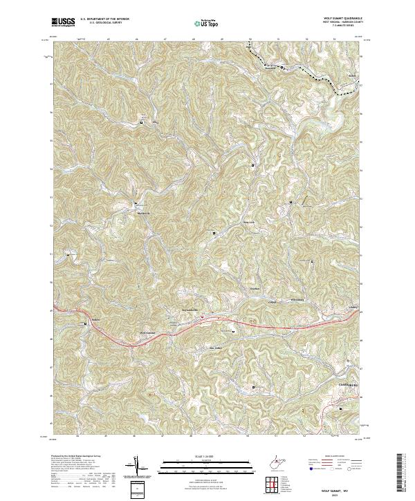
Wolf Summit and the surrounding Harrison County hills are defined by a network of narrow hollows and ridge-line roads connecting small, historic settlements. The landscape is dotted with several family and community burial grounds, including the Olive Branch Cem, Sardis Cem, and Ash Cem, reflecting the deep-rooted genealogy of the rural district. In the southern portion of the sheet, the North Bend Rail-Trl follows the historic path of the Baltimore and Ohio Railroad, passing through Maken and Wolf Summit toward the industrial fringes of Clarksburg. This transit corridor parallels US Rte 50, which serves as the primary artery between towns like Reynoldsville and Wilsonburg. Further north, smaller hamlets such as Marshville and Dola sit along the winding banks of Tenmile Creek and Isaac Creek, where the terrain transitions into more isolated farmland and wooded valleys like Gladys Hollow.
Find a feature on this map
145 named features on this map. Tap any name to fly to it.
Don’t see what you’re looking for? This feature index may not catch every label — zoom into the map to look around manually.
Map Details
Editions of this 2023 Wolf Summit Map
This is the sole edition of this map. No revisions or reprints were ever made.