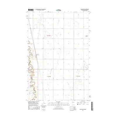
2016 Map of Wolverton
USGS Topo · Published 2016About this map
The Red River of the North carves a complex, meandering path along the western edge of this landscape, defining the state border between Minnesota and North Dakota. In this fertile valley of Wilkin County, the small settlement of Wolverton serves as the primary hub, surrounded by a grid of agricultural section lines and rural routes like Co Rd 190 and Co Hwy 30. The map documents a landscape heavily managed for drainage and cultivation, noted by features such as Wolverton Cr, Nyquist Coulee, and the engineered County Ditch Number Five-A. For those researching local families, the presence of the Wolverton Cem and Schmitt Cem provides specific points of interest. The area's rural character is further detailed by named farm routes, including Hanson Fm Rd, which reflect the localized transportation network of this Red River Valley community.
Find a feature on this map
41 named features on this map. Tap any name to fly to it.
Don’t see what you’re looking for? This feature index may not catch every label — zoom into the map to look around manually.
Map Details
Editions of this 2016 Wolverton Map
This is the sole edition of this map. No revisions or reprints were ever made.
Other maps of this area

1895 · Fargo
USGS Topo · 1:125,000

1897 · Fargo
USGS Topo · 1:125,000

1904 · Wahpeton
USGS Topo · 1:125,000

1953 · Fargo
USGS Topo · 1:250,000

1956 · Fargo
USGS Topo · 1:250,000

1959 · Hickson
USGS Topo · 1:24,000

1959 · Christine
USGS Topo · 1:24,000

1960 · Galchutt
USGS Topo · 1:24,000

1964 · Baker
USGS Topo · 1:24,000
1964 · Comstock
USGS Topo · 1:24,000