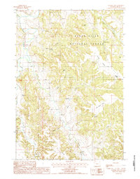
1984 Map of Wonder View
USGS Topo · Published 1985About this map
Black Hills National Forest land dominates this section of Crook County, where the topography transitions from the winding course of the Belle Fourche River into a complex series of ridges and canyons. The settlement of Wonder View sits on the eastern edge of the quadrangle, serving as a focal point for a landscape defined by significant water management and livestock grazing infrastructure. Numerous flowing wells and springs are documented throughout the drainage basins of Kara Creek and Miller Creek, which feed into the larger river system.
Find a feature on this map
23 named features on this map. Tap any name to fly to it.
Don’t see what you’re looking for? This feature index may not catch every label — zoom into the map to look around manually.
Map Details
Editions of this 1984 Wonder View Map
This is the sole edition of this map. No revisions or reprints were ever made.
Other maps of this area

1905 · Devils Tower
USGS Topo · 1:125,000

1918 · Moorcroft
USGS Topo · 1:125,000

1918 · Moorcroft
USGS Topo · 1:62,500

1954 · Sunny Divide
USGS Topo · 1:24,000

1954 · Carlile
USGS Topo · 1:24,000

1954 · Missouri Buttes
USGS Topo · 1:24,000

1954 · Gillette
USGS Topo · 1:250,000

1955 · Devils Tower
USGS Topo · 1:62,500

1955 · Gillette
USGS Topo · 1:250,000

1957 · Nefsy Divide
USGS Topo · 1:62,500