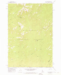
1962 Map of Wood Hump
USGS Topo · Published 1975About this map
The Selway River winds through this high-elevation wilderness within the Bitterroot National Forest, where steep drainages and prominent ridges define the landscape. The peak at Wood Hump Lookout VABM 7224 stands as a central navigation point, overlooking a complex network of waterways including Wilkerson Creek, Swet Creek, and Surprise Creek. To the north, the terrain transitions at Thompson Flat, while the eastern portion of the sheet reaches the crest of Storm Ridge near the boundary of the Salmon National Forest. This 1962 field-checked survey documents a region of Idaho characterized by its absence of modern development, showing only trails and natural features like Three Lakes and Stripe Lake tucked into the high basins of Goat Ridge.
Find a feature on this map
26 named features on this map. Tap any name to fly to it.
Don’t see what you’re looking for? This feature index may not catch every label — zoom into the map to look around manually.
Map Details
Editions of this 1962 Wood Hump Map
2 editions found
Other maps of this area

1956 · Elk City
USGS Topo · 1:250,000

1960 · Elk City
USGS Topo · 1:250,000

1962 · Wood Hump
USGS Topo · 1:24,000

1962 · Beaver Jack Mtn
USGS Topo · 1:24,000

1962 · Blue Joint
USGS Topo · 1:24,000

1962 · Square Top
USGS Topo · 1:24,000

1962 · Horse Creek Butte
USGS Topo · 1:24,000

1962 · Nez Perce Peak
USGS Topo · 1:24,000

1978 · Waugh Mountain
USGS Topo · 1:24,000

1978 · Magruder Mtn
USGS Topo · 1:24,000