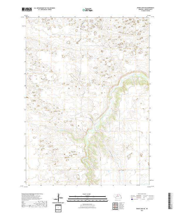
2021 Map of Wood Lake NE
USGS Topo · Published 2021About this map
Plum Cr meanders through the eastern section of this Nebraska landscape, creating a distinct riparian corridor through the high plains of Brown County. The terrain is characterized by the unique topography of the Sandhills, featuring prominent landforms such as the Sand Draw and various depressions typical of this prairie ecosystem. Settled within the Public Land Survey System grids of T31N and T32N, the area is largely defined by its drainage patterns, including the westward-reaching Little Minnie Cr. Human activity is primarily represented by Norden Rd, which provides the primary north-south transit route through these sparsely populated ranchlands. This map captures the intersection of water and wind-sculpted earth, showing how the limited water sources of the region dictate the local geography.
Find a feature on this map
8 named features on this map. Tap any name to fly to it.
Don’t see what you’re looking for? This feature index may not catch every label — zoom into the map to look around manually.
Map Details
Editions of this 2021 Wood Lake NE Map
This is the sole edition of this map. No revisions or reprints were ever made.
Other maps of this area

1950 · Norden
USGS Topo · 1:62,500

1950 · Huddle Table
USGS Topo · 1:24,000

1950 · Wood Lake
USGS Topo · 1:62,500

1952 · Norden
USGS Topo · 1:62,500

1954 · Ainsworth NW
USGS Topo · 1:24,000

1954 · Ainsworth SW
USGS Topo · 1:24,000

1955 · O'Neill
USGS Topo · 1:250,000

1957 · Valentine
USGS Topo · 1:250,000

1959 · Valentine
USGS Topo · 1:250,000

1959 · O'Neill
USGS Topo · 1:250,000