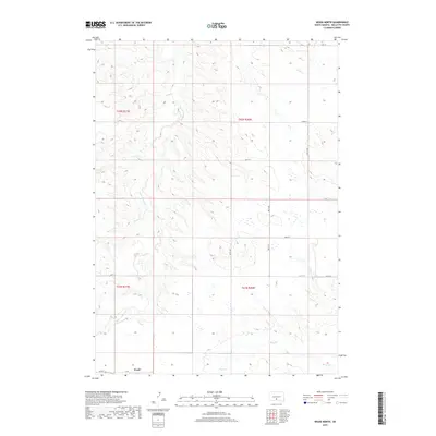
2017 Map of Wood North
USGS Topo · Published 2017About this map
Wood sits at the southern edge of this landscape in Mellette County, where the plains are defined by the intermittent drainages of White Thunder Cr and Butte Cr. The terrain reflects the expansive open-range character of South Dakota's south-central prairie, organized by a strict sectional grid of rural routes including 287th Ave and 267th St. While the town itself occupies the southwestern corner, the majority of the area is given over to the draws and rises of the watershed, including Louis Cr in the northeast. This 2017 survey documents the modern road network, from local connectors like Co Rd 44 to the section-line roads that facilitate movement across the agricultural and ranching interior of the Rosebud region.
Find a feature on this map
19 named features on this map. Tap any name to fly to it.
Don’t see what you’re looking for? This feature index may not catch every label — zoom into the map to look around manually.
Map Details
Editions of this 2017 Wood North Map
This is the sole edition of this map. No revisions or reprints were ever made.
Other maps of this area

1951 · Badnation
USGS Topo · 1:24,000

1951 · White River NE
USGS Topo · 1:24,000

1951 · Badnation NW
USGS Topo · 1:24,000

1955 · Martin
USGS Topo · 1:250,000

1958 · Martin
USGS Topo · 1:250,000

1982 · Mission NE
USGS Topo · 1:24,000

1982 · White River SE
USGS Topo · 1:24,000

1982 · Wood North
USGS Topo · 1:24,000

1982 · Badnation SE
USGS Topo · 1:25,000

1982 · Mosher
USGS Topo · 1:25,000