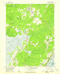
1958 Map of Woodbine
USGS Topo · Published 1959About this map
Belleplain State Forest and the vast Great Cedar Swamp dominate this mid-century look at Cape May County, where the infrastructure of the Pennsylvania-Reading Seashore Lines cuts through the low-lying wetlands. The borough of Woodbine serves as a primary hub, notable for the State Colony and the Woodbine Municipal Airport. Cultural history is well-preserved through numerous small settlements and religious landmarks, including Tiffereth Israel Cem and the United Brotherhood Cem.
Find a feature on this map
60 named features on this map. Tap any name to fly to it.
Don’t see what you’re looking for? This feature index may not catch every label — zoom into the map to look around manually.
Map Details
Editions of this 1958 Woodbine Map
3 editions found
Other maps of this area

1884 · Sea Isle
USGS Topo · 1:62,500

1888 · Dennisville
USGS Topo · 1:62,500

1888 · Sea Isle
USGS Topo · 1:62,500

1890 · Great Egg Harbor
USGS Topo · 1:62,500

1890 · Tuckahoe
USGS Topo · 1:62,500

1893 · Great Egg Harbor
USGS Topo · 1:62,500

1893 · Tuckahoe
USGS Topo · 1:62,500

1894 · Dennisville
USGS Topo · 1:62,500

1894 · Sea Isle
USGS Topo · 1:62,500

1918 · Great Egg Harbor
USGS Topo · 1:62,500