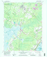
1958 Map of Woodbine
USGS Topo · Published 1986About this map
Pennsylvania-Reading Seashore Lines define the transportation corridor of this interior Cape May County landscape, linking the borough of Woodbine and Woodbine Junction to the surrounding woodland and swamp. The map documents a community deeply rooted in its environment, where the Belleplain State Forest and the expansive Great Cedar Swamp frame local industry and settlement. Notable institutional presence includes the State Colony and the Woodbine Municipal Airport, while the smaller hamlets of Dennisville, South Dennis, and Goshen appear as historic clusters along the winding Dennis Creek.
Find a feature on this map
80 named features on this map. Tap any name to fly to it.
Don’t see what you’re looking for? This feature index may not catch every label — zoom into the map to look around manually.
Map Details
Editions of this 1958 Woodbine Map
3 editions found
Other maps of this area

1884 · Sea Isle
USGS Topo · 1:62,500

1888 · Dennisville
USGS Topo · 1:62,500

1888 · Sea Isle
USGS Topo · 1:62,500

1890 · Great Egg Harbor
USGS Topo · 1:62,500

1890 · Tuckahoe
USGS Topo · 1:62,500

1893 · Great Egg Harbor
USGS Topo · 1:62,500

1893 · Tuckahoe
USGS Topo · 1:62,500

1894 · Dennisville
USGS Topo · 1:62,500

1894 · Sea Isle
USGS Topo · 1:62,500

1918 · Great Egg Harbor
USGS Topo · 1:62,500