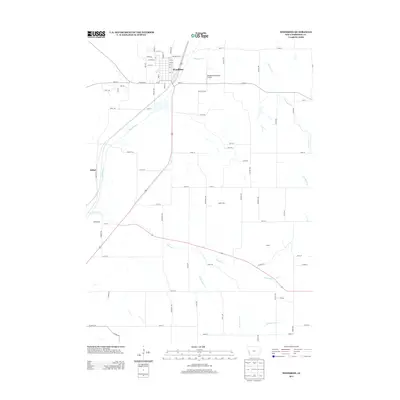
2013 Map of Woodbine
USGS Topo · Published 2013About this map
Woodbine serves as the primary hub of this Harrison County landscape, situated where the Boyer River valley meets a network of local agricultural roads. The town's layout is defined by a grid of numbered streets and named avenues like Normal St and Pandora Ave, with the Woodbine Municipal Airport located just to the east. The surrounding countryside is drained by several meandering waterways, including Sixmile Cr, Richardson Cr, and the various branches of Picayune Cr. Small named locales such as Jeddo City, Ojedo, Whitesboro, and Willett are scattered throughout the rural sections, marking the historical distribution of smaller communities across the prairie. The road network, including the diagonal path of Bus Brown Dr and numerous named trails like Perry Trl, reflects a transition from early pioneer routes to the modern transportation corridors of western Iowa.
Find a feature on this map
79 named features on this map. Tap any name to fly to it.
Don’t see what you’re looking for? This feature index may not catch every label — zoom into the map to look around manually.
Map Details
Editions of this 2013 Woodbine Map
This is the sole edition of this map. No revisions or reprints were ever made.
Other maps of this area

1954 · Omaha
USGS Topo · 1:250,000

1957 · Omaha
USGS Topo · 1:250,000

1958 · Omaha
USGS Topo · 1:250,000

1970 · Logan
USGS Topo · 1:24,000
1970 · Beebeetown
USGS Topo · 1:24,000

1971 · Moorhead SE
USGS Topo · 1:24,000

1971 · Dunlap SW
USGS Topo · 1:24,000

1971 · Dunlap
USGS Topo · 1:24,000
1978 · Hard Scratch
USGS Topo · 1:24,000

1978 · Persia
USGS Topo · 1:24,000