
1970 Map of Logan
USGS Topo · Published 1972About this map
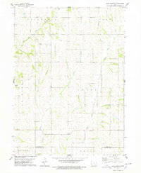
The Boyer River and the Chicago and North Western railroad corridor define the landscape of this Harrison County study. The town of Logan serves as a local hub, situated at the confluence of transport and water, featuring mid-century infrastructure like a Radio Tower, Sewage Disposal facility, and a nearby Landing Strip. To the northwest, Magnolia remains a distinct settlement surrounded by the township divisions of Magnolia, Boyer, Calhoun, and Jefferson. The terrain is deeply carved by drainage systems including Willow Creek, Hoffman Creek, and Thompson Creek, illustrating the complex topography of the Loess Hills region. For genealogists and local historians, the map preserves the exact locations of the Boyer Cem and Silver Hill Cem, alongside a Gravel Pit that points toward the area's geological and industrial activity.
Find a feature on this map
20 named features on this map. Tap any name to fly to it.
Don’t see what you’re looking for? This feature index may not catch every label — zoom into the map to look around manually.
Map Details
Editions of this 1970 Logan Map
This is the sole edition of this map. No revisions or reprints were ever made.
Other maps of this area

1954 · Omaha
USGS Topo · 1:250,000

1957 · Omaha
USGS Topo · 1:250,000

1958 · Omaha
USGS Topo · 1:250,000
1970 · Missouri Valley
USGS Topo · 1:24,000
1970 · Beebeetown
USGS Topo · 1:24,000
1970 · Missouri Valley NW
USGS Topo · 1:24,000

1971 · Moorhead SE
USGS Topo · 1:24,000

1971 · Dunlap SW
USGS Topo · 1:24,000
1971 · Pisgah
USGS Topo · 1:24,000
1978 · Hard Scratch
USGS Topo · 1:24,000