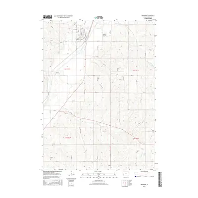
2015 Map of Woodbine
USGS Topo · Published 2015About this map
Woodbine serves as the focal point of this Harrison County landscape, situated along the valley of the Boyer River. The town's grid is well-defined, stretching from 1st St up to 11th St, with the Woodbine Municipal Airport located just to the northeast. The surrounding terrain is deeply carved by a network of waterways, including Sixmile Cr, Picayune Cr, and Richardson Cr, which create the distinct ridges and valleys characteristic of this part of western Iowa. For family historians, the map is remarkably detailed, noting several smaller burial sites outside the main Woodbine Cem. These include Greenwood Cem, Cowan-Pardee Cem, and Mefferd Cem, each positioned on the high ground overlooking the creek bottoms. The road network, comprising routes like Ia 44 and various township roads, follows both the rectilinear land survey and the natural contours of the undulating loess hills landscape.
Find a feature on this map
52 named features on this map. Tap any name to fly to it.
Don’t see what you’re looking for? This feature index may not catch every label — zoom into the map to look around manually.
Map Details
Editions of this 2015 Woodbine Map
This is the sole edition of this map. No revisions or reprints were ever made.
Other maps of this area

1954 · Omaha
USGS Topo · 1:250,000

1957 · Omaha
USGS Topo · 1:250,000

1958 · Omaha
USGS Topo · 1:250,000

1970 · Logan
USGS Topo · 1:24,000
1970 · Beebeetown
USGS Topo · 1:24,000

1971 · Moorhead SE
USGS Topo · 1:24,000

1971 · Dunlap SW
USGS Topo · 1:24,000

1971 · Dunlap
USGS Topo · 1:24,000
1978 · Hard Scratch
USGS Topo · 1:24,000

1978 · Persia
USGS Topo · 1:24,000