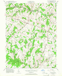
1945 Map of Woodbine
USGS Topo · Published 1967About this map
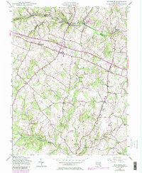
Baltimore and Ohio rail lines follow the winding course of the Patapsco River along the northern boundary of this mid-1940s landscape. This area, spanning the borders of Carroll, Howard, and Montgomery Counties, is defined by a network of agricultural settlements and water-powered history. Several historic milling sites are recorded, including Carrs Mill, Hipsleys Mill, and Roxbury Mills, indicating the importance of local waterways like Cattail Creek and the Patuxent River to the rural economy. In the central and southern portions of the map, the terrain is dotted with small communities such as Lisbon, Cooksville, and Glenwood, connected by a developing road system that includes an early marked 4 Lane highway. This survey captures the region just as post-war infrastructure began to reach these established Piedmont farming towns.
Find a feature on this map
32 named features on this map. Tap any name to fly to it.
Don’t see what you’re looking for? This feature index may not catch every label — zoom into the map to look around manually.
Map Details
Editions of this 1945 Woodbine Map
6 editions found
Other maps of this area

1892 · Laurel
USGS Topo · 1:62,500

1892 · Ellicott
USGS Topo · 1:62,500

1893 · Frederick
USGS Topo · 1:125,000

1894 · Ellicott
USGS Topo · 1:62,500

1894 · Laurel
USGS Topo · 1:62,500

1894 · Frederick
USGS Topo · 1:125,000

1897 · Laurel
USGS Topo · 1:62,500

1906 · Ellicott
USGS Topo · 1:62,500

1907 · Laurel
USGS Topo · 1:62,500

1908 · Patapsco
USGS Topo · 1:125,000