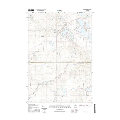
2015 Map of Woodboro
USGS Topo · Published 2015About this map
The Wisconsin River winds through the southern reaches of this landscape, carving a path through the glaciated terrain of the Oneida Co and Lincoln Co border. In the northern half, the settlement of Woodboro serves as a small hub for the surrounding lake country, where numerous water bodies like Squash Lake, Crescent Lake, and Washburn Lake dominate the geography. The map reveals a high concentration of recreational and residential development concentrated around these shorelines, evidenced by a dense network of local roads such as Lake Rest Rd and Crestwood Dr. Genealogical interest is anchored by the Woodboro Cemetery, while the presence of named islands like Big Island and Little Island in the larger lakes suggests a well-established pattern of seasonal and year-round waterfront living. To the south, the terrain becomes more dominated by drainage systems like Jennie Cr and N Br Pine Cr near Harrison Lake.
Find a feature on this map
95 named features on this map. Tap any name to fly to it.
Don’t see what you’re looking for? This feature index may not catch every label — zoom into the map to look around manually.
Map Details
Editions of this 2015 Woodboro Map
This is the sole edition of this map. No revisions or reprints were ever made.
Other maps of this area

1939 · Cassian
USGS Topo · 1:48,000

1940 · Parrish
USGS Topo · 1:48,000

1940 · Rhinelander
USGS Topo · 1:48,000

1942 · Cassian
USGS Topo · 1:48,000

1949 · Rhinelander
USGS Topo · 1:48,000

1950 · Parrish
USGS Topo · 1:48,000

1950 · Tomahawk
USGS Topo · 1:48,000

1952 · Parrish
USGS Topo · 1:48,000

1952 · Tomahawk
USGS Topo · 1:48,000

1954 · Iron Mountain
USGS Topo · 1:250,000