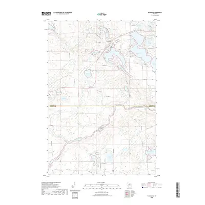
2018 Map of Woodboro
USGS Topo · Published 2018About this map
Woodboro serves as the focal point of this northern Wisconsin landscape, where the boundary between Oneida Co and Lincoln Co divides a region defined by an intricate network of glacial lakes and the winding path of the Wisconsin River. This survey captures a dense cluster of water bodies including the sprawling Squash Lake, Crescent Lake, and Mirror Lake, which are dotted with landforms like Big Island and Little Island. Local history is anchored by the Woodboro Cem and the natural flow of Woodboro Springs, while the river downstream features the Whirlpool Rapids. The map details a transition from the structured residential roads near the lakes to the more open forest land and marshy reaches of Mud Lake and Capitola Lake further south. Long-established routes like Mail Route RD and Old HWY A RD provide insight into the rural transportation patterns that have connected these lakeside communities for generations.
Find a feature on this map
96 named features on this map. Tap any name to fly to it.
Don’t see what you’re looking for? This feature index may not catch every label — zoom into the map to look around manually.
Map Details
Editions of this 2018 Woodboro Map
This is the sole edition of this map. No revisions or reprints were ever made.
Other maps of this area

1939 · Cassian
USGS Topo · 1:48,000

1940 · Parrish
USGS Topo · 1:48,000

1940 · Rhinelander
USGS Topo · 1:48,000

1942 · Cassian
USGS Topo · 1:48,000

1949 · Rhinelander
USGS Topo · 1:48,000

1950 · Parrish
USGS Topo · 1:48,000

1950 · Tomahawk
USGS Topo · 1:48,000

1952 · Parrish
USGS Topo · 1:48,000

1952 · Tomahawk
USGS Topo · 1:48,000

1954 · Iron Mountain
USGS Topo · 1:250,000