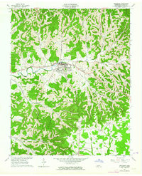
1962 Map of Woodbury
USGS Topo · Published 1964About this map
The Stones River and its East Fork converge in this central Tennessee landscape, where the town of Woodbury serves as a focal point for the surrounding hollows and ridges. In the early 1960s, the community supported a concentrated residential core near the Filtration Plant and Brewer Cemetery, while the broader terrain is defined by family-named landmarks and rural outposts. Small settlements such as Davenport, Sheybogan, and Iconium are linked by winding routes like 70s and 53.
Find a feature on this map
52 named features on this map. Tap any name to fly to it.
Don’t see what you’re looking for? This feature index may not catch every label — zoom into the map to look around manually.
Map Details
Editions of this 1962 Woodbury Map
2 editions found
Other maps of this area

1893 · Mc Minnville
USGS Topo · 1:125,000

1895 · Mc Minnville
USGS Topo · 1:125,000

1908 · Woodbury
USGS Topo · 1:62,500

1913 · Hollow Springs
USGS Topo · 1:62,500

1936 · Beech Grove
USGS Topo · 1:24,000

1936 · Petty Gap
USGS Topo · 1:24,000

1942 · Statesville
USGS Topo · 1:100,000

1943 · Mc Minnville
USGS Topo · 1:100,000

1952 · Centertown
USGS Topo · 1:24,000

1953 · Chattanooga
USGS Topo · 1:250,000