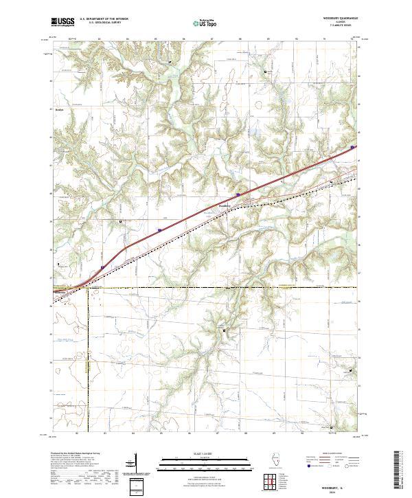
2024 Map of Woodbury
USGS Topo · Published 2024About this map
The agricultural landscape of Cumberland County is defined by a dense network of watercourses and rural burial grounds, centered on the small community of Woodbury. This area is characterized by a complex drainage system including Muddy Creek, Cottonwood Creek, and Island Creek, which carve through the till plains of South-Central Illinois. The settlement pattern is anchored by the historic National Rd, running parallel to Cumberland Rd through the heart of the township. Genealogists will find a wealth of family history sites, as the map meticulously details numerous cemeteries scattered across the county lines, such as Elliott Cem, Farmer Cem, and Mullen Cem. Near the intersection of Effingham and Jasper counties, Montrose marks the southern edge of this survey, while the quiet waters of Woodbury Lake provide a notable landmark just west of the Woodbury settlement.
Find a feature on this map
44 named features on this map. Tap any name to fly to it.
Don’t see what you’re looking for? This feature index may not catch every label — zoom into the map to look around manually.
Map Details
Editions of this 2024 Woodbury Map
This is the sole edition of this map. No revisions or reprints were ever made.
Other maps of this area

1933 · Toledo
USGS Topo · 1:62,500

1934 · Mattoon
USGS Topo · 1:62,500

1937 · Mattoon
USGS Topo · 1:62,500

1938 · Toledo
USGS Topo · 1:62,500

1940 · Greenup
USGS Topo · 1:62,500

1943 · Greenup
USGS Topo · 1:62,500

1953 · Teutopolis
USGS Topo · 1:62,500

1958 · Decatur
USGS Topo · 1:250,000

1961 · Decatur
USGS Topo · 1:250,000
1984 · Neoga
USGS Topo · 1:24,000