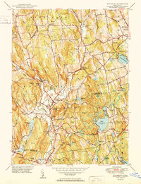
1950 Map of Woodbury
USGS Topo · Published 1950About this map
Regina Laudis Priory and the surrounding hills of Bethlehem and Woodbury define the northern portion of this 1950 survey. The landscape is a network of ridges and river valleys, where the Weekeepeemee River and Nonewaug River converge near Hotchkissville and North Woodbury to form the Pomperaug River. This mid-century view documents the region before modern suburban expansion, showing a dense concentration of local landmarks such as Taft Sch in Watertown and the prominent Orenaug Hills with its Lookout Tower.
Find a feature on this map
93 named features on this map. Tap any name to fly to it.
Don’t see what you’re looking for? This feature index may not catch every label — zoom into the map to look around manually.
Map Details
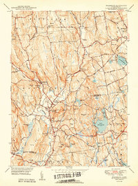
Editions of this 1950 Woodbury Map
2 editions found
Other maps of this area

1889 · Derby
USGS Topo · 1:62,500

1891 · Derby
USGS Topo · 1:62,500

1892 · Danbury
USGS Topo · 1:62,500

1892 · New Milford
USGS Topo · 1:62,500

1893 · Waterbury
USGS Topo · 1:62,500

1893 · New Milford
USGS Topo · 1:62,500

1893 · Derby
USGS Topo · 1:62,500

1904 · New Milford
USGS Topo · 1:62,500

1904 · Waterbury
USGS Topo · 1:62,500

1904 · Litchfield
USGS Topo · 1:125,000