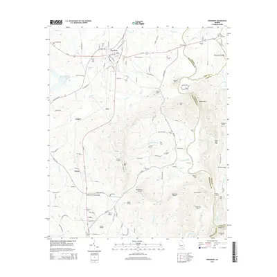
2014 Map of Woodbury
USGS Topo · Published 2014About this map
Woodbury serves as the focal point for this survey of the Georgia Piedmont, where the local road network radiates toward surrounding hamlets like Betts and Persico. The landscape is defined by the winding course of the Flint River and a complex series of ridges including Pine Mtn and Betts Mtn. To the west of the river, smaller settlements such as Johnson Crossroads and Loftin are mapped alongside numerous family and church burial grounds, including the Thompson Cem and Concord Cem. The presence of Lawrences Mill on Elkins Cr indicates the historical importance of water power in this rural economy. Significant elevation changes are marked by landmarks like Huckleberry Pinnacle and Dixon Mtn, which overlook the hollows and gaps that once dictated the path of regional travel and settlement.
Find a feature on this map
130 named features on this map. Tap any name to fly to it.
Don’t see what you’re looking for? This feature index may not catch every label — zoom into the map to look around manually.
Map Details
Editions of this 2014 Woodbury Map
This is the sole edition of this map. No revisions or reprints were ever made.
Other maps of this area

1907 · Talbotton
USGS Topo · 1:125,000

1934 · Warm Springs
USGS Topo · 1:62,500

1935 · Thomaston
USGS Topo · 1:48,000

1936 · Warm Springs
USGS Topo · 1:62,500

1939 · Thomaston
USGS Topo · 1:62,500

1953 · Atlanta
USGS Topo · 1:250,000

1955 · Phenix City
USGS Topo · 1:250,000

1957 · Phenix City
USGS Topo · 1:250,000

1957 · Atlanta
USGS Topo · 1:250,000

1958 · Phenix City
USGS Topo · 1:250,000