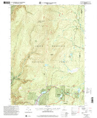
1997 Map of Woodford
USGS Topo · Published 2000About this map
Woodford sits at the heart of this high-elevation landscape in Bennington County, where the transition from mid-century topographic data to late-1990s revisions reveals a territory deeply managed for recreation and conservation. The intersection of the Long Trail and the Appalachian Trail follows the spine of Glastenbury Mountain, a rugged terrain punctuated by the Glastenbury Mountain Lookout and the Goddard Shelter. This high country, largely contained within the Green Mountain National Forest, is defined by its drainage systems, including the Fayville Branch and Bolles Brook.
Find a feature on this map
48 named features on this map. Tap any name to fly to it.
Don’t see what you’re looking for? This feature index may not catch every label — zoom into the map to look around manually.
Map Details
Editions of this 1997 Woodford Map
This is the sole edition of this map. No revisions or reprints were ever made.
Other maps of this area

1889 · Wilmington
USGS Topo · 1:62,500

1891 · Wilmington
USGS Topo · 1:62,500

1894 · Londonderry
USGS Topo · 1:62,500

1894 · Equinox
USGS Topo · 1:62,500

1896 · Equinox
USGS Topo · 1:62,500

1898 · Bennington
USGS Topo · 1:62,500

1899 · Londonderry
USGS Topo · 1:62,500

1899 · Wilmington
USGS Topo · 1:62,500

1900 · Taconic
USGS Topo · 1:125,000

1900 · Equinox
USGS Topo · 1:62,500