
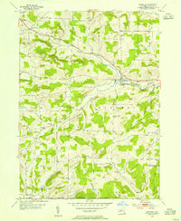
1953 Map of Woodhull
USGS Topo · Published 1954About this map
Woodhull serves as a primary hub for this Southern Tier landscape, situated along the Liberty Highway where Tuscarora Creek flows east. The area in the early 1950s was defined by a dense network of local school districts, many of which are identified here by name, including Red Sch, Sly Sch, Pulteney Hill Sch, and Norway Ridge Sch. These small, localized educational centers, along with the Chenango Ch and various family-named landmarks like Earl Beatty Hill, reflect a well-established rural social structure just north of the New York Pennsylvania Boundary. The terrain transitions from the broader valley of the South Branch Tuscarora Creek to the high ridges of Rathbone and Norway Ridge, where the Norway Ridge Cem marks generations of local residents. This survey preserves the exact placement of homesteads and small settlements such as Five Corners, Chenango, and Owlville before modern consolidation altered the rural fabric.
Find a feature on this map
32 named features on this map. Tap any name to fly to it.
Don’t see what you’re looking for? This feature index may not catch every label — zoom into the map to look around manually.
Map Details
Editions of this 1953 Woodhull Map
2 editions found
Other maps of this area

1899 · Gaines
USGS Topo · 1:62,500

1900 · Gaines
USGS Topo · 1:62,500

1900 · Elkland
USGS Topo · 1:62,500

1924 · Woodhull
USGS Topo · 1:48,000

1926 · Woodhull
USGS Topo · 1:62,500

1926 · Greenwood
USGS Topo · 1:62,500

1944 · Woodhull
USGS Topo · 1:62,500

1950 · Elmira
USGS Topo · 1:250,000

1953 · Cameron
USGS Topo · 1:24,000
1953 · Borden
USGS Topo · 1:24,000