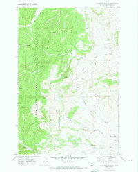
1970 Map of Woodhurst Mountain
USGS Topo · Published 1973About this map
Woodhurst Mountain and Tollgate Mountain dominate this section of the Lewis and Clark National Forest in central Montana. Surveyed in the late 1960s and published in 1973, the map illustrates a landscape shaped by both resource extraction and conservation. Evidence of local industry appears at the Strip Mine in the northwest corner and scattered Prospects throughout the gulches, while the presence of the Judith River Game Range Hdqrs points to early wildlife management efforts.
Find a feature on this map
23 named features on this map. Tap any name to fly to it.
Don’t see what you’re looking for? This feature index may not catch every label — zoom into the map to look around manually.
Map Details
Editions of this 1970 Woodhurst Mountain Map
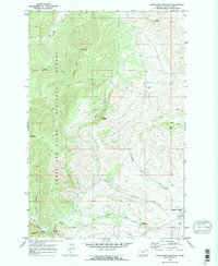
2 editions found
Other maps of this area

1886 · Little Belt Mts.
USGS Topo · 1:250,000

1890 · Fort Benton
USGS Topo · 1:250,000

1892 · Fort Benton
USGS Topo · 1:250,000

1894 · Little Belt Mts.
USGS Topo · 1:250,000

1897 · Fort Benton
USGS Topo · 1:250,000

1897 · Little Belt Mts.
USGS Topo · 1:250,000

1898 · Little Belt Mts.
USGS Topo · 1:250,000

1902 · Little Belt Mts.
USGS Topo · 1:250,000

1948 · White Sulphur Springs
USGS Topo · 1:250,000

1954 · Great Falls
USGS Topo · 1:250,000