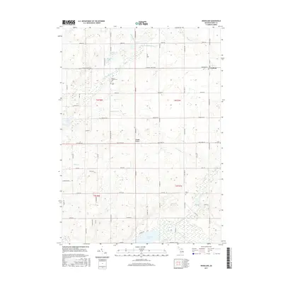
2017 Map of Woodland
USGS Topo · Published 2017About this map
Woodland sits in the northeastern corner of this Barry County landscape, where the local grid of rural roads meets at Broadway St and S Main St. The surrounding countryside is defined by a dense network of glacial lakes and winding waterways, including the Little Thornapple River and Coldwater River. Small family and community landmarks are scattered across the township, such as the Barnum Neighborhood Cem and Fuller Cem, which serve as vital touchstones for local genealogy. To the south, the village of Coats Grove and its namesake Coats Grove Cem mark an area where the terrain shifts toward more significant water bodies like Thornapple Lake and Cloverdale Lake. This survey illustrates a quiet agricultural and recreational era, where the drainage of the Mallison Ditch and Gravel Brook shapes the productive land between established homesteads.
Find a feature on this map
72 named features on this map. Tap any name to fly to it.
Don’t see what you’re looking for? This feature index may not catch every label — zoom into the map to look around manually.
Map Details
Editions of this 2017 Woodland Map
This is the sole edition of this map. No revisions or reprints were ever made.
Other maps of this area

1916 · Ionia
USGS Topo · 1:62,500

1918 · Ionia
USGS Topo · 1:62,500

1918 · Lowell
USGS Topo · 1:62,500

1943 · Ionia
USGS Topo · 1:62,500

1943 · Lowell
USGS Topo · 1:62,500

1950 · Nashville
USGS Topo · 1:62,500

1951 · Nashville
USGS Topo · 1:62,500

1951 · Hastings
USGS Topo · 1:62,500

1958 · Grand Rapids
USGS Topo · 1:250,000

1961 · Grand Rapids
USGS Topo · 1:250,000