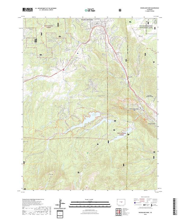
2022 Map of Woodland Park
USGS Topo · Published 2022About this map
Woodland Park serves as the primary hub of this 2022 survey, marking a significant gateway into the high-elevation terrain of the Pike National Forest. The landscape is defined by the sharp transition from the residential grids of Woodland Park to the steep drainages of the Rampart Range. Transportation through this corridor follows the historic route of the Ute Pass Regional Trl, which links the valley floor with high-mountain communities like Green Mountain Falls and Crystola.
Find a feature on this map
117 named features on this map. Tap any name to fly to it.
Don’t see what you’re looking for? This feature index may not catch every label — zoom into the map to look around manually.
Map Details
Editions of this 2022 Woodland Park Map
This is the sole edition of this map. No revisions or reprints were ever made.
Other maps of this area

1893 · Platte Canyon
USGS Topo · 1:125,000

1893 · Colorado Springs
USGS Topo · 1:125,000

1894 · Pikes Peak
USGS Topo · 1:125,000

1894 · Castle Rock
USGS Topo · 1:125,000

1901 · Pikes Peak
USGS Topo · 1:125,000

1901 · Pikes Peak
USGS Topo · 1:62,500

1909 · Colorado Springs
USGS Topo · 1:125,000

1913 · Castle Rock
USGS Topo · 1:125,000

1942 · Colorado Springs
USGS Topo · 1:125,000
1948 · Manitou Springs
USGS Topo · 1:24,000