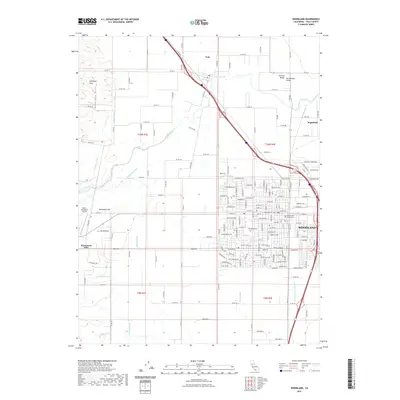
2021 Map of Woodland
USGS Topo · Published 2021About this map
Woodland serves as the focal point of this modern survey, anchoring the intersection of agricultural industry and civic life in the Sacramento Valley. The street grid reveals a dense urban center home to the Yolo County Courthouse and the sprawling grounds of the Woodland Cem. To the north and west, the landscape shifts abruptly to the irrigated plains of the Central Valley, defined by an intricate network of water management features including the Acacia Canal, Magnolia Canal, and the Farmers Central Ditch. These waterways support the region's productive farmlands between the Dunnigan Hills and the winding course of Cache Creek. In the outlying areas, smaller hubs like Yolo and Sugarfield contrast with the aviation activity at Watts-Woodland Airport, illustrating how transportation and irrigation infrastructure have shaped this Yolo County landscape into the twenty-first century.
Find a feature on this map
97 named features on this map. Tap any name to fly to it.
Don’t see what you’re looking for? This feature index may not catch every label — zoom into the map to look around manually.
Map Details
Editions of this 2021 Woodland Map
This is the sole edition of this map. No revisions or reprints were ever made.
Other maps of this area

1907 · Dunnigan
USGS Topo · 1:62,500

1907 · Woodland
USGS Topo · 1:62,500

1907 · Davisville
USGS Topo · 1:62,500

1910 · Knights Landing
USGS Topo · 1:31,680

1915 · Yolo
USGS Topo · 1:31,680

1915 · Swingle
USGS Topo · 1:31,680

1915 · Ronda
USGS Topo · 1:31,680

1915 · Merritt
USGS Topo · 1:31,680

1916 · Grays Bend
USGS Topo · 1:31,680

1916 · Jacobs Corner
USGS Topo · 1:31,680