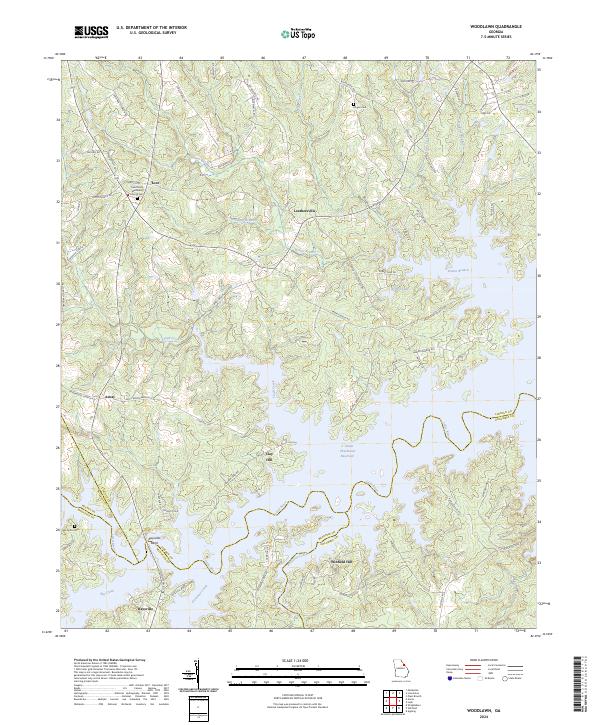
2024 Map of Woodlawn
USGS Topo · Published 2024About this map
J. Strom Thurmond Reservoir and the winding Little River dominate this modern landscape where the borders of Lincoln, Columbia, McDuffie, and Wilkes counties meet. This area is characterized by flooded river valleys and fingers of land that create complex shorelines, most notably at Raysville Bend. These contemporary waters have submerged much of the low-lying terrain, leaving settlements like Amity, Clay Hill, and Leathersville situated on the higher ridges overlooking the reservoir.
Find a feature on this map
80 named features on this map. Tap any name to fly to it.
Don’t see what you’re looking for? This feature index may not catch every label — zoom into the map to look around manually.
Map Details
Editions of this 2024 Woodlawn Map
This is the sole edition of this map. No revisions or reprints were ever made.
Other maps of this area

1892 · Mc Cormick
USGS Topo · 1:125,000

1906 · Crawfordville
USGS Topo · 1:125,000

1912 · Mc Cormick
USGS Topo · 1:125,000

1921 · Appling
USGS Topo · 1:62,500

1943 · Appling
USGS Topo · 1:62,500

1953 · Athens
USGS Topo · 1:250,000

1954 · Metasville
USGS Topo · 1:24,000

1958 · Athens
USGS Topo · 1:250,000

1959 · Athens
USGS Topo · 1:250,000

1963 · Athens
USGS Topo · 1:250,000