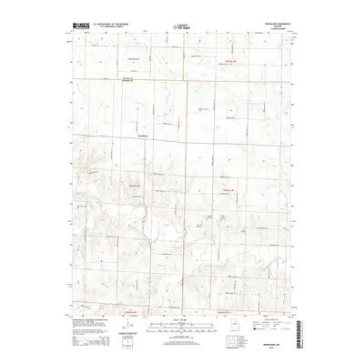
2014 Map of Woodlawn
USGS Topo · Published 2014About this map
Woodlawn sits at the heart of this rural Missouri landscape, marking a transition between the northern agricultural uplands and the southern river bottoms. The terrain is defined by the winding course of the Middle Fork Salt River, which is fed by numerous smaller tributaries including Flat Cr, Mud Cr, and Big Br. This network of waterways has long dictated the layout of the local road system, which follows the ridgelines and section lines of the township and range survey. The presence of several family or community burial grounds, such as Atterberry Cemetery, Forest Grove Cemetery, and Milner Cemetery, provides a record of the long-standing settlement patterns in this part of Monroe County. The map also captures the Shelby Co Monroe Co line, illustrating the administrative boundaries that intersect the rolling prairies and timbered creek bottoms of north-central Missouri.
Find a feature on this map
57 named features on this map. Tap any name to fly to it.
Don’t see what you’re looking for? This feature index may not catch every label — zoom into the map to look around manually.
Map Details
Editions of this 2014 Woodlawn Map
This is the sole edition of this map. No revisions or reprints were ever made.
Other maps of this area

1890 · Moberly
USGS Topo · 1:125,000

1908 · Macon
USGS Topo · 1:62,500

1910 · Macon
USGS Topo · 1:62,500

1952 · Middle Grove
USGS Topo · 1:24,000

1953 · Moberly
USGS Topo · 1:250,000

1954 · Moberly
USGS Topo · 1:250,000

1957 · Moberly
USGS Topo · 1:250,000

1958 · Lentner
USGS Topo · 1:24,000

1959 · Shelbina
USGS Topo · 1:24,000
1959 · Woodlawn
USGS Topo · 1:24,000